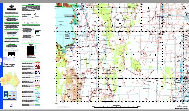
Yaringa 1-250,000 Topographic Map
$15.95 – $30.95
Description:
Print on Demand
10 Mile Bore 23 Mile Bore 5 Mile Bore Billabong Roadhouse Boolagoorda Carbla Clayton Well Coburn Cooloomia Corktree Well Crabhole Well Curleys Dam East Tank Enteprise Mine Evans Bore Flag Pole Landing Flint Cliff Four Corners Tank Four Tanks Garries Lagoon Hamelin Hamelin Outcamp Hamelin Pool Hamelin Pool Marine Nature Resv Homestead Bore Hutchison Islands Ilga Well Johnnie Well Kevins Bore Meadow Milylia Well Mungawolagudi Claypan Nilemah No. 1 Bore No. 1 Tank No. 10 Bore No. 11 Bore No. 12 Bore No. 13 Bore No. 14 Bore No. 15 Bore No. 16 Bore No. 17 Bore No. 18 Bore No. 19 Bore No. 2 Bore No. 2 Tank No. 20 Bore No. 21 Bore No. 22 Bore No. 23 Bore No. 3 Bore No. 4 Bore No. 5 Bore No. 5 Tank No. 6 Bore No. 6 Dam No. 6 Tank No. 7 Bore No. 8 Bore No. 9 Bore No. 9a Bore Old Woodleigh Overlander Roadhouse Shell Ridges Spinifex Bore Sweeney Mia Bore Talisker Toolonga Toolonga Nature Reserve Towry Well Wannoo Wardawara Pool Wolarry Bore Wolarry Claypan Woodleigh Yalardy Yaringa Point Carnarvon Basin Milylia Hamelin Pool Marine Nature Reserve Yaringa South Flagpole Landing North Dulacca Meadows Wolarry Waterhole Number Six Dam
| Name: | Yaringa |
| Publisher: | Geoscience Australia (Australian Government) |
| Scale: | 1:250000 |
| Latitude Range: | 26° 0.0′ S – 27° 00.0′ S |
| Longitude Range: | 114° 0.0′ E – 115° 30.0′ E |
| Projection / Datum: | Universal Transverse Mercator, GDA94 |
| Approx Print Size: | 0.44m X 0.67m |
| Publication Date: | 1-Jun-02 |


