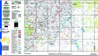
Wave Hill 1-250,000 Topographic Map
$15.95 – $30.95
Description:
Print on Demand
Locations within this Map
Kalkarindji Wave Hill 14 Mile Creek 14 Mile Waterhole 14 Mile Yard 4 Corners Bore 5 Mile Creek Alpha Bore Barry Creek Barry Creek Bore Barry Knob Barry Knob Bore Bentans Bore Billy Creek Bilyanarri Hill Biri Hill Blackfellows Knob Blackgin Bore Blackgin Hill Blackgin Waterhole Blackgin Yard Bobs Gully Yard Boundary Bore Bull Paddock Bore Bullock Creek Burtawurta Creek Cahills Rockhole Camerons Bore Camfield Camfield Bore Camfield Creek Camfield Yard Catfish Waterhole Cattle Creek Cattle Creek Landing Ground Chungamidgee Bore Chungamidgee Waterhole Chungaree Bore Chungari Creek Corkwood Bore Corner Bore Costa Tszyu Bore Croker Creek Croker Spring Croker Yard Crowsons Bore Daguragu Daguragu Health Centre Delamere Bore Dodderal Bore Downer Hill Dude Bore Edgar Creek Egan Bore Eight Mile Rise Elsey Bore Elsie Creek Extension Hill Farquharson Bore Farquharson Gap Fergusson Creek Fever Creek Fischers Bore Flora Bore Foreman Bore Four Mile Waterhole Gap Hill Gidyea Creek Giles Creek Giles Creek Yard Gill Creek Gordon Bore Gordy Creek Gordy Springs Highljinks Bore Horse Creek Bore Horse Spring Hughie Creek Johnnys Bore Junction Bore Junction Waterhole Junjaminji Waterhole Kalkarindji Kalkaringi Cemetery Kalkaringi Police Station Kalkarinji Community Health Centre Kalkarinji Pre School Kalkarinji School Kalkgurung Aerodrome Kelly Bore Kelly Creek Kelmans Bore Kookaburra Bore Larry Rockhole Larson Bore Lignum Bore Liku Lochart Hill Lochart Spring Lochart Yard Mc Donald Creek Mcdonald Bore Mcdonald Yard Mcdonalds Yard Mcquigans Bore Michaels Bore Middle Bore Middle Creek Bore Midge Bore Midge Creek Midnight Creek Mistake Bore Moray Bore Mother Dillons Knob Mount Baines Mount Deakin Mount George Mount George Bore Mount Glass Mount Gordon Mount Possum Mount Possum Bore Mount Reid Mount Seale Mount Watson Mount Williams Mount Wollaston Mountain Spring Bore Muckeldons Creek Mud Springs Creek Neave Creek Nero Bore Nero Creek Nicholson Bore No 1 Bore No 1 Yard No 12 Bore No 14 Bore No 15 Bore No 17 Bore No 18 Bore No 19 Bore No 2 Bore No 2 Dam No 22 Bore No 23 Bore No 25 Bore No 29 Bore No 3 Bore No 3 Yard No 4 Bore No 48 Bore No 5 Bore No 5 Yard No 6 Bore No 7 Bore No 8 Bore No 9 Bore Number 47 Bore Number 48 Bore Nutwood Bore Old Station Bore Old Wave Hill Pannikin Creek Parrot Creek Pear Tree Creek Pidgeon Gully Bore Poison Creek Poison Creek Bore Poison Creek Yard Quinn Bore Quirks Bore Ram Creek Bore Red Dam Red Hill Red Rock Rennie Creek Rennie Creek Yard Renny Bore Revolver Creek Rifle Bore Rifle Waterhole S Bore Sailor Park Bore Salty Bore Sambo Bore Sambo Creek Sandstone Waterhole Sandstone Yard Seale Yard Silky Bore Sisters Bore Soda Creek South Point Spring Creek Stevens Creek Stock Route Bore Stone Yard Springs Stuart Bore Sunshine Bore Taylors Creek Taylors Springs Ten Mile Waterhole The Sisters Toby Creek Topsy Bore Turners Bore W C Bore W E Bore W F Bore W G Bore Wattie Creek Wave Hill Wave Hill Airstrip Wave Hill Cemetery Webb Bore Webb Creek Willeroo Bore Willicks Bore Wyalong Creek Wyalong Yard Yankee Doodle Bore Mount Wallaston Number Seventeen Bore Number Two Bore Number Forty-Seven Bore Number Eighteen Bore Fourteen Mile Waterhole Chungari Chungaree Spring Number One Bore Number Four Bore Fourteen Mile Creek Chungaree Creek Number Twenty-Two Bore Five Mile Creek Waltie Blackgin Creek Gordie Creek Topsy Creek Number Two Dam Red Lily Creek Black Mountain Chungaminjie Well Mount Nero Blue Lagoon Gordie Spring Nero Spring Poison Corner Bore Ferguson Well Mindie Well Cap Hill Barrie Creek Dog Creek Maggie Creek
| Name: | Wave Hill |
| Publisher: | Geoscience Australia (Australian Government) |
| Scale: | 1:250000 |
| Latitude Range: | 17° 0.0′ S – 18° 00.0′ S |
| Longitude Range: | 130° 30.0′ E – 132° 0.0′ E |
| Projection / Datum: | Universal Transverse Mercator, GDA94 |
| Approx Print Size: | 0.44m X 0.67m |
| Publication Date: | 1-Jun-03 |


