
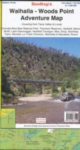
Walhalla Woods Point Adventure Map Rooftop LAMINATED
$25.00
Description:
PAPER ALSO AVAILABLE, SEE BELOW
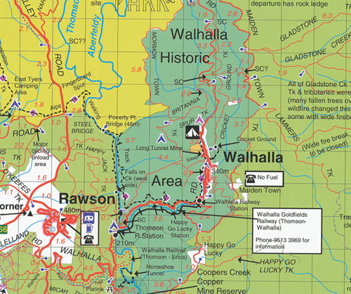
The 3rd edition of this highly popular map has been extended through the Latrobe Valley to the South Gippsland Hills.
Coverage now includes Baw Baw National Park, Thomson Reservoir, Heyfield, Mirboo North, Lake Glenmaggie, Traralgon, Moe, Erica, Aberfeldy, Tyers, Morwell, Blackwarry, Tarra-Bulga National Park and Won Wron. Mt Selma
Roads and tracks have been carefully plotted using a GPS and all important recreational and land features have been included plus the 2006 wildfire boundary in the Tyers and Moondarra State Parks.
The main map is at 1:100,000 scale.
On the reverse side is the Walhalla – Woods Point Forest Activities Map at 1:50,000 scale with contours.
Published May 2013
LAMINATED, PAPER ALSO AVAILABLE
ISBN 9781921886102
https://www.mapsbookstravelguides.com.au/walhalla-woods-point-adventure-map-rooftop/
You may also like…
-
Walhalla Woods Point Adventure Map Rooftop
$12.95 – $25.00Select options This product has multiple variants. The options may be chosen on the product page -
Walhalla 1-50,000 Vicmap
$12.00 – $24.00Select options This product has multiple variants. The options may be chosen on the product page -
Walhalla North 1-25,000 Vicmap
$12.00 – $24.00Select options This product has multiple variants. The options may be chosen on the product page -
Warburton 1-250,000 Topographic Map
$15.95 – $30.95Select options This product has multiple variants. The options may be chosen on the product page -
Walhalla South 1-25,000 Vicmap
$12.00 – $24.00Select options This product has multiple variants. The options may be chosen on the product page