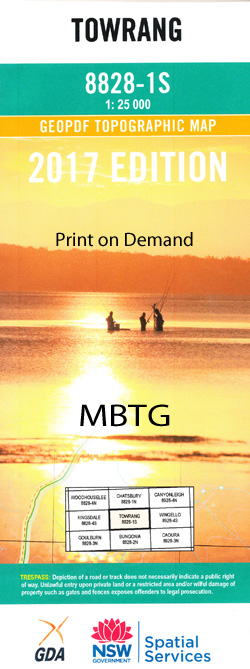
Towrang 1-25,000 NSW Topographic Map
$16.95 – $31.95
Description:
8828-1-S Print on Demand
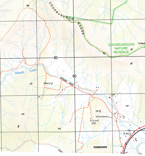
Argyle Billyrambija Boxers Creek Bradfordville Public School Brayton Carrick Carrick Railway Station Chapmans Creek Cookbundoon Cookbundoon Range Gap Range Goulburn Cemetery Governor Governors Hill Hungry Hill Jobson Kenmore Kenmore Railway Station Goulburn General Cemetery Hogans Gully Longreach Lockyersleigh Lockyersleigh Creek Murrays Flats Murrays Flats Railway Station Narrangarril Nattery Nattery Hill Norrong The Old Stockade Osborns Creek Plumb Rankin Scraggy Creek Shaws Creek Shelly Shellys Flat Stillers Creek Stilwells Creek Stony Range Hill Strathfield Tarlo Gap Throsbys Ford Towrang Towrang Creek Mount Towrang Towrang Railway Station Towrang Stockade Wandi Creek Narambulla Creek Wilds Pass Laurieleigh Murray Flats Mulwaree Ponds North Goulburn
| Name: | Towrang |
| Publisher: | New South Wales Government |
| Scale: | 1:25000 |
| Latitude Range: | 34° 37.5′ S – 34° 45.0′ S |
| Longitude Range: | 149° 45.0′ E – 150° 0.0′ E |
| Datum: | GDA 94 |
| Approx Print Size: | 0.56m X 1.11m |