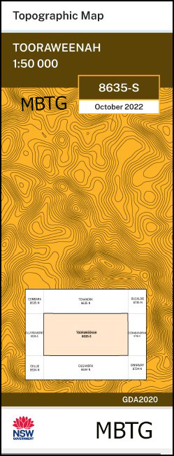
Tooraweenah 1-50,000 NSW Topographic Map
$16.95 – $28.95
Description:
Tooraweenah 1-50,000 NSW topographic map 8635S Now Print on Demand
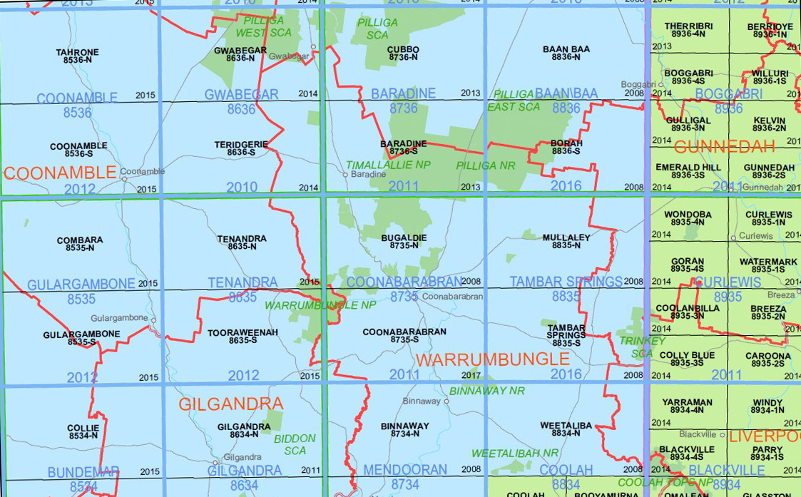
Warrumbungle National Park is covered by the Coonabarabran 1-50,000 , Tooraweenah 1-50,000, Tenandra 1-50,000 and a small section on the Bugaldie 1-50,000 topographic maps
Tooraweenah 1-50,000 scale NSW Topographical map is used for Walking, 4WD, Fishing, Camping, Motorcycle, both On and Off Road, Gold Prospecting and for those simply going for a family weekend drive.
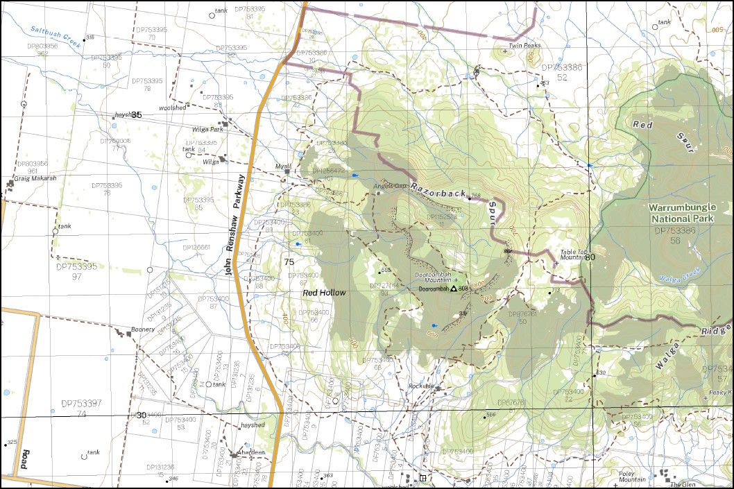
Topographical maps show not only Contours of the Terrain but also Walking Tracks, Sealed and Unsealed Roads, Rivers, Creeks, Lakes, Historical Point of Interest, Old Mine Sites mbtg and National and State Park areas.
Locations within this Map
Bundah Oakwood Stornaway Gumin Wambelong Wongy Evelyn Park Weenya Topwalga Wokolena Gleneda Tara Mullengah Hydon Woodlands Warrien Butterworth Alva Quandong Macanbar Argyle Belougery Wombawidgee Cordale Wilgaleigh Clancy Westella Nioka Wilga Park Wilber Wilga Mandoora Rob Roy Major Park Pine Grove Boonery Myall Beery Letona Tonderburine Brunker Park Mt Terrace Wyalla Cadonia Aberdeen Cherry Tree Dooroombah The Glen Uamble Gunneemooroo Mariemon Tarralea Karrawingi Ashburn Cannya Daylesford Wyuna Ringdogin Uluma Abbeywood Khan Yunis Windurong Bringle Yootha Wattle Park Allawah Studholme Reedsdale Panuara Coonawarra Oakleigh Braeburn Sunnyside Mountain View Ferndale Laurel Hills Armatree Inglebrook Kirwee Laldoone Wonga Park Kirriwah Niangah Allandale Rosedale Wilga Grove Mundar Glen Iris Glenaire Wambrook Avondale Kimberlee Nilma Havilar Old Mundar Kurrajong Park Kelvin Kerry Tooraweenah Angels Gap Allamurgoola Creek Mount Ailinn Ailinn Creek Armatree Public School Allamurgoola Ados Spring Baile Rock Bald Hill Baldy Mountain Balor Peak Baronne Creek Baronne Gully Belagery or Belougery Spire Belagery Split Rock or Crater Bluff Belougery Gully Belougery Spire Belougery Split Rock Bluff Pyramid Bluff Mountain Bluff Creek Black Plains Creek Black Mountain Blackmans Mountain Booroonbunyah Spring The Breadknife Bress Peak Brigit Peak Callangoan Camp Elongery Camp Pincham Camp Wambelong Canyon Camp Carwell Lagoon castle Rock Cathedral Arch Churchill Rock Cobbinbil Collie Colpa Crater Bluff Crooked Creek Currajong Creek Dagda Saddle Danu Saddle Mount Exmouth Fans Horizon Freeguards Prospect Gap Creek Gibbs Gap Grand High Tops Grassy Glades Gulargambone Creek Guneemooroo Gully Gunnyannah Spring Hells Corner Hillside Iron Knob Judes Creek Camp Burbie Coles Creek Dagda Gap Danu Gap Freemans Prospect Galargambone Creek Gunntanna Spring Lucas Terrace Mariemon Creek Mariemon Creek Swamp Magie Melon Creek Mogie Melon Watercourse Monkeybung Spring Mount Lughtainne Mount Mider Mount Terra Terra Munkerbung Spring Muraiman Creek Naman Creek Naman Ledges Mount Naman Maman or Wattle Spring Nemzie Creek New Spring New Spring Creek Nuada Saddle Nullen Creek Ogma Saddle Orella Creek Paddys Creek Paddys Rocks Peaky Knob Peaky Nob Picnic Ground Mountain Poley Mountain Quandong Public School Razorback Spur Red Hollow Red Mountain Red Spur Reedy Creek Rocky Waterhole Creek Saddle Mountain Saltbush Creek Sky Mountain Snake Spring Spire Creek Split Rock Gully Spring Creek Sreng Boss Table Top Mountain Tarambijal Terrabile Creek Mount Terrabile Mount Terrace Terra Terra Creek Terra Terra Gully Terra Terra Mountain The Black Mountain Tonderburine Creek Tonderburine Gully Tonduron Tonduron Creek Tonduron Gully Tonduron Spire Toora Creek Tooraweanah Toorawfanah Creek Mount Tooraweenah Tooraweanah Public School Tooraweenah Public School Tooraweenah Ridge Top Walga Creek Tunderbrine Tunderbrine Creek Tunderbrine Gully Tunnel Spring Twin Peaks Uargon Valley Walga Creek Walga Peak Walga Ridge Walga Spring Wallaby Flat Wallaroy Creek Wambawidgee Creek Wambelong Mountain Warrumbungle Range Waterford Hill Mount Waterford Wattle Creek Wattle Spring Western High Tops West Spirey Creek Wilber Creek Point Wilderness Willson Hill Windurong Public School Wongy Tank Yarrandale Public School Youlbung Bull Mountain Bullocky Hill Dooroombah Mountain Dows High Tops Dows Lookout Doyles Prospect Doorumbah Mountain Burbie Camp Burbie Canyon Burbie Creek Burbie Gap Burbie Hill Mount Burbie Burbie Spring Kookaburra Memorial Park Razorback Range Walga Range Box Ridge Gumin Gumin Toshs Wongy Wambelong Creek Berry Tunderbrine Bore Spire Mountain Tonduran Tonduron Mountain Bunbunya Bourgonbulla Nullen Uargon Bidden
| Name: | Tooraweenah |
| Publisher: | New South Wales Government |
| Scale: | 1:50,000 |
| Latitude Range: | 31° 15.0′ S – 31° 30.0′ S |
| Longitude Range: | 148° 30.0′ E – 149° 0.0′ E |
| Datum: | GDA 2020
Edition 2022 |
You may also like…
-
Coonabarabran 1-50,000 NSW Topographic Map
$16.95 – $28.95Select options This product has multiple variants. The options may be chosen on the product page -
Tenandra 1-50,000 NSW Topographic Map
$16.95 – $28.95Select options This product has multiple variants. The options may be chosen on the product page -
Bugaldie 1-50,000 NSW Topographic Map
$16.95 – $28.95Select options This product has multiple variants. The options may be chosen on the product page


