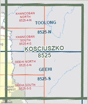
Toolong 1-50,000 Vicmap
$12.00 – $24.00
Description:
Toolong 1-50,000 scale Vicmap Topographical map 8525N is used for Walking, 4WD, Fishing, Camping, Motorcycle, both On and Off Road, Gold Prospecting and for those simply going for a family weekend drive.
Topographical maps show not only Contours of the Terrain but Walking Tracks, Sealed and Unsealed Roads, Rivers, Creeks, Lakes, Historical Points of Interest, Old Mine Sites mbtg and National and State Park areas.
Main Features of this map includes:
Murray River into NSW
Khancoban Pondage, Greg Greg, SNAKEY PLAIN Track, Swampy Plains Creek Track, Yellow Bog Road, Tooma Road, Tooma River Trail,
Part of the Bicentennial Trail
Khancoban, Towong Upper, Whitehead Track, Carleys Lookout, Bringenbrong, Khancoban Pondage, Murray 1 Power Station, Mont Waters Spring, Finlays Lookout
You may also like…
-
Geehi 1-50,000 Vicmap
$12.00 – $24.00Select options This product has multiple variants. The options may be chosen on the product page -
Nariel 1-50,000 Vicmap
$12.00 – $24.00Select options This product has multiple variants. The options may be chosen on the product page -
Corryong 1-50,000 Vicmap
$12.00 – $24.00Select options This product has multiple variants. The options may be chosen on the product page -
Toolong 1-50,000 Vicmap
$12.00 – $24.00Select options This product has multiple variants. The options may be chosen on the product page -
KHANCOBAN SOUTH 1-25,000 Vicmap Topographic Map 8525-4-S
$14.00 – $26.00Select options This product has multiple variants. The options may be chosen on the product page -
KHANCOBAN NORTH 1-25,000 Vicmap Topographic Map 8525-4-N
$14.00 – $26.00Select options This product has multiple variants. The options may be chosen on the product page -
Chimney Ridge 1-25,000 NSW Topographic Map
$16.95 – $29.95Select options This product has multiple variants. The options may be chosen on the product page -
Tallangatta 1-250,000 Topographic Map
$15.95 – $27.95Select options This product has multiple variants. The options may be chosen on the product page -
Australian Alpine Walking Track Map Set 1
$390.00 – $600.00Select options This product has multiple variants. The options may be chosen on the product page


