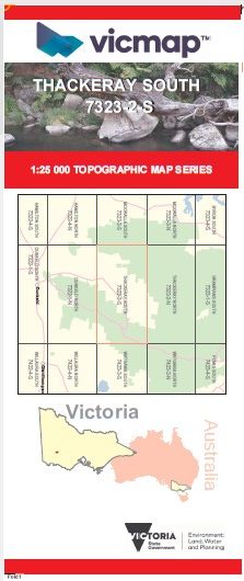


THACKERAY SOUTH 1-25,000 Vicmap Topographic Map 7323-2-S
$14.00 – $26.00
Description:
THACKERAY SOUTH 1-25,000 Vicmap Topographic Map 7323-2-S Now Print On Demand is used for Walking, 4WD, Fishing, Camping, Motorcycle, both On and Off Road, Gold Prospecting and for those simply going for a family weekend drive.
This is a new series of 1-25,000 scale maps, all sections of Victoria are now covered by these maps, including maps over the South Australian and NSW Borders.
Topographical maps show not only Contours of the Terrain but Walking Tracks, Sealed and Unsealed Roads, Rivers, Creeks, Lakes, Historical Points of Interest, Old Mine Sites mbtg and National and State Park areas.
Main Features of this map includes:
Covers the old series 1-25,000 Vicmaps Bullawin and MIRRANATWA
Victoria Range Remote and Natural Area, MOUNT WILLIAM RANGE, Strachans, Strachans Campground, Chimney Pot Gap, BULLAWIN FR, Burnt Hut Creek Track, Mirranatwa, MIRRANATWA BR, Mirranatwa Gap, Mount Burchell, Serra Range, Yarram Gap, Wannon Crossing Campground, MOUNT MARUM MARUM / MOUNT NELSON, Jimmy Creek Campground, TALBERT POINT
You may also like…
-
Thackeray 1-50,000 Vicmap
$12.00 – $24.00Select options This product has multiple variants. The options may be chosen on the product page -
THACKERAY NORTH 1-25,000 Vicmap Topographic Map 7323-2-N
$14.00 – $26.00Select options This product has multiple variants. The options may be chosen on the product page -
Southern Grampians Outdoor Recreation Guide Map SV
$19.95 – $29.95Select options This product has multiple variants. The options may be chosen on the product page -
Grampians Peaks Trail Map Set
$26.95 – $50.95Select options This product has multiple variants. The options may be chosen on the product page