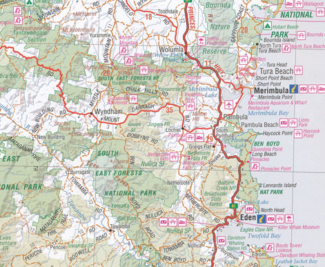
South East New South Wales Map Hema FLAT Laminated
Description:
South East New South Wales Map Hema FLAT Laminated
Please see our alternatives below including the New Edition Hema map South Coast map which was originally folded
A regional map of South East New South Wales (1:385,000) that stretches from the New South Wales-Victoria border up to Wollongong. On the opposite side of the map is tourist information on specific regions, including Illawarra, Northern and Southern Shoalhaven, Eurobodalla Nature Coast, the Sapphire Coast, the Southern Highlands, Goulburn region and the Hume Highway region.
- Camping areas
- Tourist information
- National parks
- Wilderness areas
- Points of interest
| Product Format | Folded Map |
| Barcode | 9781865007236 |
| Unfolded Size (WxH) | 700 x 1000 mm |
| Cover Size (WxHxD) | 140 x 250 x 3 mm |
Read More
You may also like…
-
South Coast New South Wales Flat Map
$15.95 – $27.95Select options This product has multiple variants. The options may be chosen on the product page -
Far East Victoria Southern NSW Flat Map
$15.95 – $27.95Select options This product has multiple variants. The options may be chosen on the product page -
Wilderness Coast Map Bemm River to Pambula
$15.95 – $25.95Select options This product has multiple variants. The options may be chosen on the product page

