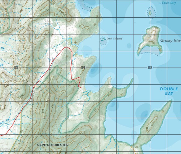
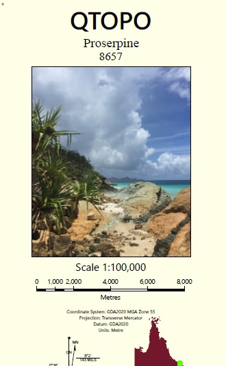
Proserpine 1-100,000 Topographic Map
$15.95 – $30.95
Description:
Locations within this Map
Collingvale Cannonvale Airlie Beach Hamilton Island Proserpine Shutehaven Wilson Beach Conway Beach Airlie Bay Airlie Creek Albert Creek Alert Bank Almora Islet Anchor Point Andersons Bay Arkhurst Island Armit Island Baird Point Base Point Bench Point Bendy Creek Bird Island Black Island Bluff Point Boat Haven Bolton Hill Bonavista Boulder Creek Box Creek Branch Creek Brandy Creek Breadalbane Bullock Creek Burtenshaw Crossing Butterfly Bay Calf Island Campbell Creek Campbells Plain Catseye Bay Cedar Creek Mount Chaine Charley Creek Cid Harbour Cid Island Conder Shoal Conway Conway Range Mount Conway Coral Point Cow Creek Cow Island Cowrie Island Crab Bay Crofton Creek Daniel Point Datum Rock Daydream Island Deadman Creek Deedes Point Deep Creek Deepwater Point Denman Island Dent Island Dolphin Point Double Bay Double Cone Island Double Rock Driftwood Bay Dry Creek Dryander Dryander Creek Mount Dryander Dugong Bay Dugong Inlet Dungurra Island East Rock Edwin Rock Emmerson Creek Eshelby Island Fire Point Firth Patch Fitzalan Island Flame Tree Creek Flying Fox Islands Fox Creek Foxdale Funnel Bay Galbraith Creek Gamut Creek Genesta Bay George Point Gilling Point Gloucester Goat Island Goorganga Goorganga Creek Goose Lagoon Grants Bank Grassy Island Green Point Gregory Creek Grimston Point Groper Point Gulnare Inlet Gumbrell Island Gunn Island Gunyarra Hannah Point Happy Bay Haswell Patch Hayman Channel Hayman Island Mount Hayward Henning Island High Mountain Hill Rock Hook Hook Island Hook Peak Mount Horn Hughes Point Humpy Point Hunt Channel Ian Point Lake Iris Mount Jeffreys Mount Julian Mount Kangaroo Katoomba Bank Ker Point Koolachu Lady Island Lagoon Creek Lamond Hill Langford Creek Langford Island Lethe Brook Little Conway Long Island Long Island Peak Long Island Sound Long Shoal Loriad Point Low Island Low Rock Lucas Creek Mackerel Bay Mount Maclear Macona Inlet Mandalay Point Manta Ray Island Mount Marlow Mount Merkara Mid Molle Island Molle Molle Channel Port Molle Morgans Creek Myrtle Creek Nara Inlet Native Dog Creek North Molle Island Notch Hill Olden Island One Foot Island Orchid Creek Palm Bay Palm Creek Palm Tree Creek Panorama Lookout Passage Peak Pear Shoals Pelican Island Perseverance Island Peter Head Pig Creek Pigeon Island Pine Head Pine Island Pinnacle Peak Pinnacle Point Pioneer Bay Pioneer Point Pioneer Rocks Planton Island Plum Pudding Island Pocket Paddock Proserpine Plain Proserpine River Mount Proserpine Puritan Bay Reef Point Repair Island Repulse Beach Repulse Creek Rocky Creek Rocky Hill Rocky Point Roma Point Rooper Inlet Mount Rooper Roseric Shoal Ross Islet Round Head Ryans Creek Saddleback Island Saltwater Creek Sawmill Bay Scrubby Hill Sealark Patch Mount Sharp Shute Bay Shute Harbour Shute Island Six Mile Creek Slater Creek South Channel South Head South Molle Island Spit Point Spring Creek Stanley Point Stonehaven Bay Stony Creek Strathdickie Stripe Point Mount Sunter Swamp Bay Mount Sydney Tailing Gully Tancred Island Tawvale The Beak The Causeway The Hump The Inlet Three Fathom Patch Three Mile Creek Trammel Bay Unsafe Passage Victoria Creek Vine Creek Waite Creek Watering Horse Creek White Rock Whitsunday Whitsunday Cairn Whitsunday Coast Whitsunday Island Whitsunday Islands National Park Whitsunday Passage Whitsunday Peak Wilson Woodcutter Bay Woodwark Bay Rattray Island Preston Whitsunday Shire Cannon Valley Cape Gloucester Cape Conway Flametree Glen Isla Goorganga Plains Hamilton Plains Jubilee Pocket Kelsey Creek Mandalay Myrtlevale Palm Grove Riordanvale Sugarloaf Whitsunday Shire Whitsundays Gregory River Whitsunday Shire Woodwark Conway National Park Molle Islands National Park Cork Hills Jones Point Fuller Point Mount Robison Fitzalan Passage Stonehaven Anchorage Dryander National Park Arkhurst Islet The Narrows Langford Islet Black Islet Cockatoo Point One Foot Islet Bird Islet Six Fathom Bank Red Bream Creek Maona Inlet Almora Island Ball Hill Lion Point North Arm Dugong Inlet North Arm of Dugong Inlet East Arm Dugong Inlet East Arm of Dugong Inlet Lady Islet Molle Islands Mount Robinson West Molle Island South Molle Tourist Camp Molle Island The Horn Babieca Summit Deauville Walle Creek Pear Shoal Loriard Point Lower Gregory Strathdickie North Hump Red Hill Windermere North Gregory Dent Passage Whitsunday Pass Young Island Woodcutters Bay Andersons Inlet Rossleigh Bona Vista Cow and Calf Islands Cow Islet Calf Islet Coorganga Creek Defiance Creek Little Conway Mountain
| Name: | 8657 |
| Publisher: | Queensland Government |
| Scale: | 1:100000 |
| Latitude Range: | 19° 58.91′ S – 20° 30.0′ S |
| Longitude Range: | 148° 30.0′ E – 149° 0.0′ E |
| Projection / Datum: | Universal Transverse Mercator, GDA 94 |
| Approx Print Size: | 0.58m X 0.56m |


