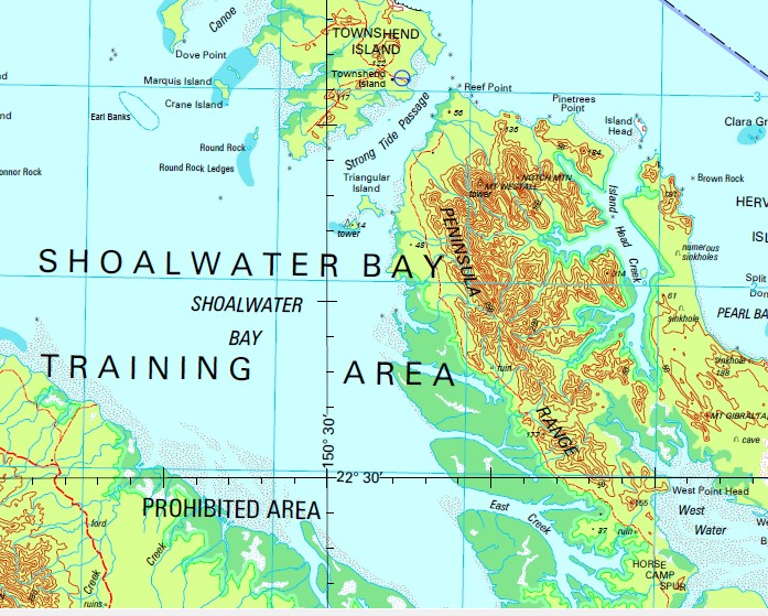
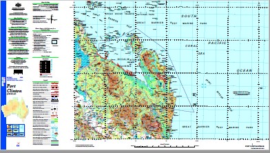
Port Clinton 1-250,000 Topographic Map
$15.95 – $30.95
Description:
Print on Demand
Townshend Island Quail Island Stanage Bay Couti Uti Pine Mountain Waratah Torilla Fernlea Keiver Wadallah Elanora Braeside The Plains Spring Valley Brampton Vale St Clair Goodnomda Hillview The Glen Montait Parnass Vale Snake Gully Calavalle Eden Garry Lowville The Springs Tarra The Hut Nerang Palm Park Princhester Grosvenor Park New St Aubans Belbroughton Lowden Glengarry Manilla Maryvale Glenavon Balmoral Akens Island Mount Alec Alnwick Island Annie Island Arthur Point Mount Atherton Banksia Banwan Creek Banyan Creek Bartletts Creek Bay Island Bayfield Mount Bayfield Big Fork Creek Black Creek Black Rock Blind Rock Block Creek Bluewater Creek Bonnie Doon Mountain Boomerang Creek Boulder Gully Boundary Flat Lagoons Brampton Creek Bridge Creek Broad Sound Channel Broome Head Brown Rock Bryant Rock Bull Lagoon Bullock Point Butcher Bird Creek Byfield Byfield Creek Byfield State Forest Cabbage Tree Creek Camp Creek Camp Gully Camp Waterhole Campbell Peak Canal Creek Cannibal Group Canoe Passage Canoona Cape Island Capsize Gully Mount Carroll castle Rock Charcoal Creek Charcoal Waterhole Charley Peak Cheviot Island Chinaman Creek Clara Group Clara Island Cliff Point Clinton Lowland Cape Clinton Coast Range Cockatoo Island Colcarra Creek Colcarra Range Colcarra Rock Collins Island Conical Mountain Connor Rock Coonyan Creek Corio Corio Bay Corisande Hills Costa Creek Couti Uti Creek Mount Couti Uti Cowan Creek Crane Island Creek Rock Danger Island Danger Shoal Delcomyn Island Diamond Creek Dismal Swamp Division Creek Dome Island Donovan Shoal Doonside Double Mountain Double Rock Double Rocks Dove Point Duck Holes Earl Banks East Branch Creek East Creek East Ridge Banks Edward Island Eliza Island Entrance Island Ewen Ewen Creek Fig Tree Creek Figtree Creek Fish Rock Fishing Creek Mount Fitz Five Mile Creek Five Rocks Five Rocks Beach Five Trees Cay Flat Island Flinders Watering Gully Mount Flinders Four Mile Creek Freshwater Bay Mount Ganter Georges Creek Mount Gibralter Gilgrea Creek Mount Gog Lake Graham Gravel Pit Creek Greenslopes Inlet Greenslopes Point Growlen Creek Halfway Black Creek Harrison Island Head Creek Hedlow Creek Hervey Islands Hexham Island Hollins Creek Holt Island Holtness Point Horse Camp Spur Mount Hummock Hutton Creek Inner Head Island Head Island Head Creek Jacks Crossing Mount Jardine Jessie Lagoons Jessie Peak Jones Creek Jordan Creek Krankeet Mountain Kunwarara Launch Rocks Leake Rock Leicester Island Light Me Pipe Gap Lingham Island Little Corio Bay Little Creek Long Shoal Louisa Creek Low Island Lucy Ravel Point Macdonald Point Magog Creek Magpie Creek Magpie Dam Manifold Manifold Hills Cape Manifold Marquis Island Maryvale Creek Maryvale Mountain Master Rocks Mount Meilland Merimal Mooly Creek Moonlight Creek Mount Moriah Mount Hummock Creek Mountain Creek Mount Mulgrave Mumford Island New Chum Creek Nine Mile Beach Nine Mile Creek Nob Creek Norberry Creek Normanby Range North Channel North East Point North Pointer North Rock North West Channel Northumberland Nortons Creek Notch Mountain Mount O’Connell Oaky Creek Observation Rock Old Keiver Oldman Lagoon Olive Creek One Mile Lagoon Osborn Island Otterbourne Island Oyster Creek Paddock Creek Paddys Waterhole Palm Tree Creek Palmer Knob Palmer Ridges Palmerston Pandanus Creek Parker Creek Parnassus Creek Mount Parnassus Passage Patch Payne Shoal Pearl Bay Pelican Rock Peninsula Peninsula Flats Peninsula Range Peaked Island Perforated Point Phantom Creek Mount Phipps Pier Head Pig Gully Pine Mountain Creek Pineapple Gully Pinetrees Point Mount Pisgah Pistol Gap Plumtree Creek Polka Creek Polygon Creek Polygon Range Port Clinton Porter Creek Pulleyup Creek Pyry Pyry Quoin Island Ranken Island Raspberry Creek Raspberry Vale Raynham Island Razorback Creek Red Creek Reef Point Ripple Island Rocky Creek Rocky Perch Roger Hills Ross Creek Rosslyn Rothbury Island Round Island Round Rock Round Rock Ledges Rowes Lagoon Sabina Point Samuel Hill Sandy Creek Sandy Point Sardine Creek Separation Banks Serpentine Creek Seventeen Mile Gap Shannon Creek Sheep Camp Waterhole Sheland Creek Shields Island Shoalwater Shoalwater Bay Shoalwater Creek Single Rock Six Mile Creek Skull Islands Solitude Creek Mount Solitude South Arm Spencer Creek Split Island Spring Creek Stanage Stanage Point Steep Island Mount Steven Stockyard Creek Stockyard Gully Stockyard Point Stony Creek Stringybark Creek Strong Tide Passage Sun Island Sunset Rock Supply Bay Swan Island Table Rock Tea Tree Creek Tea-Tree Creek Teddy Bear Creek Ten Mile Creek Ten Pin Rock The Blue Knobs The Brothers The Chain Lagoons The Gate Mountain The Gemini The Green Swamp The Oaks The Peaks The Pointer The Polygon The Three Rivers Tilpal Tilpal Creek Mount Tilpal Torilla Hill Torilla Peninsula Townshend Cape Townshend Triangular Island Turn Shoal Tweed Island Two Brothers Two Mile Creek Two Round Rocks Valentine Creek Wadallah Creek Wandilla Creek Waratah Creek Warginburra Peninsula Water Hole Creek Water Park Water Park Creek Water Park Point Werribee Werribee Creek West Bight West Flat West Hill West Point West Point Head West Ridge Banks West Water Mount Westall White Rocks White Shoal Williams Lagoon Woodville Yellow Gully Uromoko Byfield National Park Mount O’Connell National Park Woodbury Weerriba Stockyard Livingstone Shire Maryvale Livingstone Shire Five Rocks Conservation Park North Pointer Conservation Park Shoalwater Bay Conservation Park Low Islet Black Swan Rock Stannage Bay Bald Hill Jessie Lagoon Cape Townsend Cape Islet Ripple Islands Cannibal Islands The Shacks Annie Islet Mount Townshend Eliza Islet Rogers Hills Separation Bank The Hollins Edward Islet Sun Islet Mount Couti Outi Bay Islet Couti Outi Triangular Islands Spit Island Wadelah Creek Rose Creek Peninsular Range Seventeen Mile Creek Mount Gibraltar West Water Head Port Bowen Black Rock Island Boundary Creek Normandy Range High Double Mountain South Arm Port Clinton Halfway Creek George Creek Hummock Creek Seven Mile Creek Hummock Mountain Peaked Islet Peak Island Perforated Island Flat Islet Mount OConnell National Park Mount OConnell Mount OConnel Junction Creek Samuels Hill Puddock Creek Herbert Creek Tipal Princhester Creek Kunwarara Mine New Saint Aubans Mount Maryvale Bonnie Doon Blue Nobs Blue Knobs Cana Creek
| Name: | Port Clinton |
| Publisher: | Geoscience Australia (Australian Government) |
| Scale: | 1:250000 |
| Latitude Range: | 22° 0.0′ S – 23° 00.0′ S |
| Longitude Range: | 150° 0.0′ E – 151° 30.0′ E |
| Projection / Datum: | Universal Transverse Mercator, GDA94 |
| Approx Print Size: | 0.44m X 0.67m |
| Publication Date: | 1-Jun-04 |


