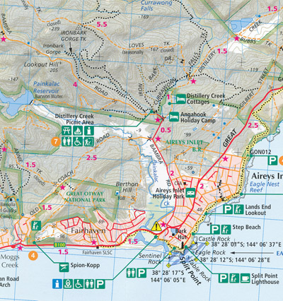
Otways East Surf Coast Map Spatial Vision FLAT
$16.95 – $28.95
Description:
Single Sided Map Only FLAT No Text Print on Demand
Victoria’s magnificent Surf Coast
Outdoor recreation guide map to Eastern Otway region (Torquay to Lorne). Ideal for bushwalking. Scale 1:50,000.
Outdoor recreation guide map to Eastern Otway region (Torquay to Lorne). Ideal for bushwalking. Scale 1:50,000.
Inset maps of Torquay & Lorne.
Detailed walk descriptions.
Recreation site locations.
Also includes:- Torquay, Point Addis, Anglesea, Aireys Inlet, Moggs Creek, Lorne, Sheoak Falls, Deans Marsh, Birregurra, Mount Cowley
Inset maps of Torquay & Lorne.
Detailed walk descriptions.
Recreation site locations.
Additional product information
| Edition | 1st edition. |
| Publication date | 2014. |
| Map Scale | 1:50,000 scale. |
| ISBN | 9780980737592. |
Read More
You may also like…
-
Otways Walking Maps Spatial Vision 3 Map Set
$39.00 – $69.00Select options This product has multiple variants. The options may be chosen on the product page -
Otways Central Walks and Waterfall Map SV
$13.95 – $28.95Select options This product has multiple variants. The options may be chosen on the product page -
Otways West Shipwreck Coast Map Spatial Vision FLAT
$26.95 – $31.95Select options This product has multiple variants. The options may be chosen on the product page

