


Numurkah 1-50,000 Vicmap
$12.00 – $24.00
Description:
Numurkah 1-50,000 scale Vicmap Topographical map 7925N is used for Walking, 4WD, Fishing, Camping, Motorcycle, both On and Off Road, Gold Prospecting and for those simply going for a family weekend drive.
Topographical maps show not only Contours of the Terrain but Walking Tracks, Sealed and Unsealed Roads, Rivers, Creeks, Lakes, Historical Points of Interest, Old Mine Sites mbtg and National and State Park areas.
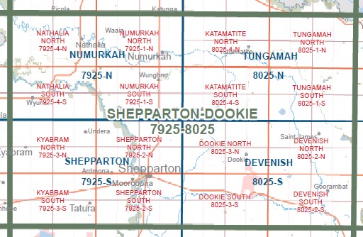
Main Features of this map includes:
Nathalia and Numurkah townships, Goulburn River, Waaia, Katunga, Numurkah-Picola Rail Line BR, Numurkah NFR, mbtg, Kinnairds Wetland, Stoleys Bridge, Galts Bridge, mbtg, Kaarimbapart of Numurkah NFR, part of Broken-Boosey SP, edge of Drumanure, Kaarimba, part of Lower Goulburn National Park, Sleeth Bend Camping Area, mbtg, Pogues Road Camping Area, Bunbartha, Rooks Track Camping Area, Loch Garry WR, Tallygaroopna, Mceniff Bend Camping Area, Harlows Track Boat Ramp, Steens Bend Camping Area
Barmah East, Numurkah Picola Rail Line BR, Nathalia NFR, part of River Murray Reserve, mbtg, part of Lower Goulburn National Park, Wakiti Creek SSR, part of Skelton Creek SSR, Wrights Bridge, Lower Moira, mbtg, MADOWLA PARK AIRFIELD, Elringtons Bridge, NARIOKA BR, James Bridge, Picola, NATHALIA NFR, SKELETON CREEK, Barwo, mbtg,
Yambuna Bridge, part of Watiki Creek SSR, Jack Pell Sandbar Camping Area, mbtg, Kotupna, Dingwell Bend Camping Area, Wyuna, Pederick, Undera North, Wyuna East, St Germains, Cattle Crossing Sand Bar Camping Area, Wakiti Creek Resort, Black Gate Camping Area 1,2 and 3, Millers Bend Camping Area, Cahills Bend Camping Area, Dawson Bend Camping Area, Pederick, Wyuna, Emily Jane Track Camping Area, Forest Bend Wyuna Camping Area, Blacks Track Wyuna Camping Area, Blacks Bend Wyuna Camping Area, Wyuna Track Camping Area 3, Vearings Lane Camping Area 1 and 2, Clarks Bend Sandbar Camping Area, Bartrops Bridge, Mccoys Bridge, Munro Road Camping Area, Kotupna, Jack Pell Sandbar Camping Area, Ronnie Track Camping Area, Big Cutting Camping Area, Big Cutting Camping Area, Undera North, Angling Club Bend Camping Area, Pump Hole Camping Area, Mill Bend Hole Camping Area, Greys Bend Camping Area
You may also like…
-
NATHALIA NORTH 1-25,000 Vicmap Topographic Map 7925-4-N
$14.00 – $26.00Select options This product has multiple variants. The options may be chosen on the product page -
Strathmerton 1-50,000 Vicmap
$12.00 – $24.00Select options This product has multiple variants. The options may be chosen on the product page -
Strathmerton 1-50,000 NSW Topographic Map
$16.95 – $31.95Select options This product has multiple variants. The options may be chosen on the product page -
Echuca 1-50,000 Vicmap
$12.00 – $24.00Select options This product has multiple variants. The options may be chosen on the product page -
Cohuna Echuca Gunbower Map Hayman
$12.95 – $25.00Select options This product has multiple variants. The options may be chosen on the product page -
NUMURKAH NORTH 1-25,000 Vicmap Topographic Map 7925-1-N
$14.00 – $26.00Select options This product has multiple variants. The options may be chosen on the product page -
NATHALIA SOUTH 1-25,000 Vicmap Topographic Map 7925-4-S
$14.00 – $26.00Select options This product has multiple variants. The options may be chosen on the product page -
Mathoura 1-50,000 Vicmap
$12.00 – $24.00Select options This product has multiple variants. The options may be chosen on the product page -
Shepparton 1-50,000 Vicmap
$12.00 – $24.00Select options This product has multiple variants. The options may be chosen on the product page -
NUMURKAH SOUTH 1-25,000 Vicmap Topographic Map 7925-1-S
$14.00 – $26.00Select options This product has multiple variants. The options may be chosen on the product page