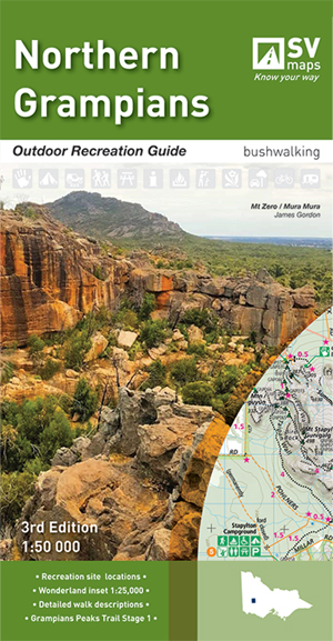
Northern Grampians Outdoor Recreation Guide Map SV
$19.95 – $29.95
Description:
Northern Grampians Outdoor Recreation Guide Map Spatial Vision
Coverage of the main map extends from about Mount William Road junction (Note: Mount William is not included) and Moora Moora reservoir in the south to Mount Zero including the whole northern sector of the Grampians National Park. The reverse side includes a 1:25,000 scale enlargement of Halls Gap and the Wonderland area. A total of 29 day walks and 2 overnight hikes are described with brief track notes including distance, difficulty gradings and estimated walking time. All walks are cross-referenced by numeric symbols to the maps.
There are also background notes on flora and fauna, other activities, safety and Aboriginal heritage.
The Northern Grampians recreation guide provides detailed maps for walking, overnight hiking, walking tracks, major activities, car and four wheel touring as well as flora and fauna. Made in conjunction with Parks Victoria, the guide also contains information about the many walks (difficulty, distance, time and elevation), major activities mbtg and local contact information.
Special Features include:
- Field checked, colour topographic map at a scale of 1:50,000.
- Visitor information regarding overnight hiking, walking tracks, major activities, car and four wheel touring as well as flora and fauna
- Overnight hiking routes and campsites.
- Walking tracks – with varying levels of difficulty, distance and duration.
- Major recreational facilities, parks and forests.
An Ideal Grampians walking map for the Northern region
Additional product information
| Edition | 3rd Edition. |
| Map Scale | 1:50,000. |
| ISBN | 9780648337645 |
SCALE: 1:50,000
COVERAGE: Halls Gap, Dadswells Bridge, Zumstein, Moora Moora Reservoir, Wartook Reservoir, and Lake Lonsdale
IDEAL FOR: Bushwalking, mountain biking and car touring
EDITION: 3
SIZE (folded):135mm wide and 250mm high
SIZE (unfolded): 675mm wide by 1000mm high
You may also like…
-
Grampians Peaks Trail Map South
$9.95 – $24.95Select options This product has multiple variants. The options may be chosen on the product page -
Grampians Peaks Trail Map Set
$26.95 – $50.95Select options This product has multiple variants. The options may be chosen on the product page -
Southern Grampians Outdoor Recreation Guide Map SV
$19.95 – $29.95Select options This product has multiple variants. The options may be chosen on the product page -
The Grampians Special 1-100,000 Topographical Map Vicmap
$12.00 – $24.00Select options This product has multiple variants. The options may be chosen on the product page -
Best Walks of the Gariwerd Grampians National Park
Select options This product has multiple variants. The options may be chosen on the product page -
Grampians Peaks Trail Map North
$9.95 – $24.95Select options This product has multiple variants. The options may be chosen on the product page -
Grampians Peaks Trail Map Central
$9.95 – $24.95Select options This product has multiple variants. The options may be chosen on the product page


