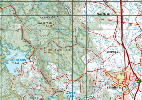
Nambour 1-100,000 Topographic Map
$15.95 – $30.95
Description:
Locations within this Map
Roseleigh Farm Beerwah Glass House Mountains Kenilworth Kilcoy Landsborough Maleny Mapleton Mooloolah Nambour Palmwoods Peachester Woodford Woombye Yandina Witta Montville Ninderry Eudlo D’Aguilar Beerburrum Conondale North Arm Flaxton Acrobat Creek Adams Creek Mount Adelaide Mount Allan Mount Ann Araucaria Creek Mount Archer August Gully Back Creek Bald Knob Baroon Pocket Lake Baroon Baxter Creek Beerburrum Creek Bella Creek Bellbird Creek Bellthorpe State Forest Bellthorpe West Blackall Range Blackrock Creek Mount Blanc Bloolou Bluegum Creek Booloumba Creek Borumba Creek Lake Borumba Mount Borumba Mount Bottle And Glass Branch Creek Bribie Broken Bridge Creek Brooloo Brooloo Gap Browns Creek Bundaroo Creek Bunya Bunya Creek Mount Cabinet Caboolture Creek Cambroon Camp Creek Candle Mountain Canning Carol Creek Cedar Creek Chambers Gully Chinaman Creek Cliff Creek Cockalorum Creek Coes Creek Mount Combe Connors Knob Conondale Range Mount Constance Coochin Coolabine Creek Cooloobin Creek Cooloolabin Dam Crohamhurst Creek Crookneck Delaney Creek Mount Denmark Donovans Knob Duff Gully Durundur Durundur Hill East Cedar Creek East Derrier Creek Elaman Creek Eudlo Creek National Park Ewen Creek Ewen Creek North Branch Ewen Creek South Branch Ewen Maddock Dam Fair Hill Ferntree Creek Ferntree Creek National Park Flagstone Creek Gap Creek Geraghty Creek Mount Gerald Gheerula Falls Gheerulla Creek Gigher Creek Point Glorious Gneering Gold Creek Goodla Creek Mount Goonneringerringgi Handy Gully Harper Creek Hell Hole Creek Highland Gully Jimna Diggings Jimna Creek Kamerigo Creek Kangaroo Creek Bonoum Kiamba Falls Kidaman Creek Kidaman Hill Kiels Mountain Kilcoy Creek Kilcoy Creek East Branch Kilcoy Creek West Branch Mount Kilcoy King Creek Kingaham Creek Kondalilla Falls Mount Langley Little Cedar Creek Little Derrier Creek Little Rocky Creek Little Yabba Creek Lobster Creek Mount Lofty London Creek Mapleton Falls Mapleton Falls National Park Maroochy Mary Smokes Creek Mount Marysmokes McColls Creek Mount McConnel Mount McLean Mount Mellum Menzies Lagoon Monkeybong Creek Mooloolah Range Mooloolah Marie Higgs Conservation Park Mossy Bank Mountain Mount Ubi Mountford Creek Moy Pocket Neurum Neurum Creek Neurum Mountain Nevisons drop New Country Creek Ngungun Ninderry Range North Maroochy River North Mooloolah River Northwest Point Oaky Creek Obi Obi Creek One Mile Creek Palm Tree Gully Pencil Creek Peters Creek Pidnung Island Pullen Pullen Creek Mount Ramsden Rock of Ages Creek Rocky Creek Rocky Gully Rocky Hole Creek Rodgers Gully Mount Rollman Rose Creek Running Creek Sandy Creek Scrub Creek Scrubby Creek Sheep Station Creek Six Mile Creek Skenes Creek Slaughter Yard Creek Snake Creek South Maroochy River South Mooloolah River Neurum Creek Conservation Park Stanton Creek Stoney Creek Stony Creek Summer Creek Summer Mountain Sunday Creek Sunshine Coast Swain Peak Tamlyn Creek The Narrows Tibberoowuccum Tibrogargan Tragedy Creek Tuckers Creek Tunbubudla Wahwoon Walli Creek Walli Mountain Wappa Dam Mount Wappa West Derrier Creek Wild Horse Mountain Wilkes Knob Willogan Creek Yied York Creek Whalleys Creek Platypus Creek Mount Cooee Conondale National Park Conondale Resources Reserve Delicia Road Conservation Park Glass House Mountains National Park Triunia National Park North Booloumba Creek South Booloumba Creek Panorama Point Mount Thilba Thalba Dularcha National Park Crohamhurst State Forest Bellthorpe Forest Reserve 1 Bellthorpe Forest Reserve 2 Conondale Forest Reserve 1 Maleny Forest Reserve 1 Maroochy Forest Reserve 2 Mooloolah Forest Reserve Villeneuve Duwirri Mick Jeffs Spur Crohamhurst Conservation Park Maleny National Park Beerburrum West State Forest Parklands State Forest Parklands Conservation Park Parklands Forest Reserve Kondalilla National Park Maroochy Forest Reserve 3 Echidna Creek Cahill Brook Balmoral Ridge Curramore Diamond Valley Mooloolah Valley North Maleny Reesville Kidaman Creek Caloundra City Belli Park Bridges Burnside Chevallum Coolabine Cooloolabin Dulong Gheerulla Highworth Hunchy Ilkley Image Flat Kiamba Kidaman Creek Maroochy Shire Kulangoor Kureelpa Landers Shoot Obi Obi Parklands Perwillowen Towen Mountain West Woombye Small Creek Pobblebonk Creek Glenfern Jimna Mount Archer Somerset Regional Council Royston Winya Fleiter Hill Stanmore Bellthorpe Booroobin Moreton Bay Regional Council Cedarton Commissioners Flat Woolmar Skipper Musk Teahouse Lookout Alcorn Creek Arley Creek Bridge Creek Clark Creek Daley Creek Falls Creek Fryar Creek Fryar Creek North Fryar Creek South Gardners Falls Graves Creek Howells Knob Lawley Creek Skene Creek Whardjin Creek Willow Creek Walkers Creek Mount Ninderry Booroobin Sunshine Coast Regional Council Crohamhurst Wootha Walker Hill Yandina Creek Borumba Dam Kenilworth Bluff Brown Creek Cheerulla Creek Cheerulla Mount Warra Connors Nob Mount Walli Yielo Booloumba Wombye Mooloolah Conservation Park Marie Higgs Conservation Park White Mountain Coochin Hills Mount Coochin Glass Mountain Peacebourne Mount Beerwah Mount Coonowrin Mount Ngungun Glass House Mount Mount Tibberoowuccum Mount Tibrogargan Tibrogargon Mount Beerburrum Mount Tunbubudla DAguilar Delaneys Creek
| Name: | 9444 |
| Publisher: | Queensland Government |
| Scale: | 1:100000 |
| Latitude Range: | 26° 30.0′ S – 27° 00.0′ S |
| Longitude Range: | 152° 30.0′ E – 153° 0.0′ E |
| Projection / Datum: | Universal Transverse Mercator, GDA 94 |
| Approx Print Size: | 0.56m X 0.56m |


