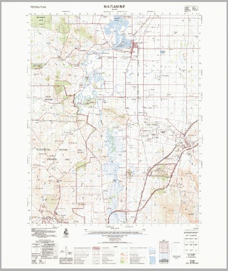
Nagambie 1-50000 Topographic Map 7924-3 VICTORIA 1987 Edition
$14.95
Description:
Nagambie 1-50,000 Topographic Map 79243 VICTORIA 1987 Edition Print on Demand
Locations within this Map
Uralla Greenbank Pine Grange Polloch Boxgrove Gilgai Maranoa Underwood Barong Melrose Park Yallambie Gundamain The Nook Stud Riverside Barwood Park Moormbool Estate Ruoemoh Chateau Tahbilk Waterbend Sweet Meadows Islay Vale Rondavel Riverview Woodlands Homelea Spring Park Goldern Heart Emohruo Sunnyside Bayunga Chatsworthpark Aberfeldie Laurel Grove Coorlong Midhurst Rose Glen Burnside Mangalore Park Hyde Park Westbrook Park Chatswood Belmont Coo-Inda Bayunga South Ludlow Park Kahala Fairview Rosedale Farm Wolbunya Avenel Estate Kemar Devon Park Northwood Park Stud Garryowen Brantwood Mittagong Engedi Bungarra Mount Alexina Nalinga Talgai Avenel Nagambie Puckapunyal Avenel Primary School Avenel Telephone Exchange McKenzie Hills Baldwins Bridge Baxters Island Bryant Hill Bunding Creek Burtons Hurdle Four Mile Creek Della Island Eight Mile Creek Emu Hill Ewing Fairview Hill Fire Hill Fraser Ridge Glass Square Goulburn Valley Highway Grahams Hill Guilds Hill Hawkes Creek Heaths Island Hughes Creek Hill Huttons Backwater Jacobsons Outlook Kinchella Hills Kobyboyn Ranges Lake Nagambie Larkin Hills Lobbs Island Lookout Hill Lovers Hill Lyon Hill Mangalore Mangalore Airport Mangalore Flora Park Mitchell Morsons Island Murdocks Hill Nagambie Fire Station Nagambie Mechanics Hall Nagambie Police Station Nagambie Primary School Nagambie Sports Ground Nagambie Telephone Exchange Northwood Northwood Hill One Tree Hill Perrys Hill Rowells Hill Sandy Creek Scrub Hill Shelton Tabilk Teddy Bear Island Tehan Hill Tobin Hill Turners Island Warfe Hill Wirrate Fire Station Woodhouse Wormangal Wormangal Creek Bailieston East Goulburn Shire Goulburn Weir Wormangle Creek Wirrate Wattle Vale Deegay Ponds Mitchellstown Mitchells Creek Majors Creek Major Creek Hawkers Creek Hughes Creek Mangalore West Victoria State of Victoria
| Name: | Nagambie |
| Publisher: | Geoscience Australia (Australian Government) |
| Scale: | 1:50000 |
| Latitude Range: | 36° 45.0′ S – 37° 00.0′ S |
| Longitude Range: | 145° 0.0′ E – 145° 15.0′ E |
| Projection / Datum: | Universal Transverse Mercator, GDA94 or WGS84 |
| Approx Print Size: | 0.56m X 0.56m |
| Publication Date: | 1-Jun-87 |
You may also like…
-
NAGAMBIE NORTH 1-25,000 Vicmap Topographic Map 7924-3-N
$14.00 – $26.00Select options This product has multiple variants. The options may be chosen on the product page -
NAGAMBIE SOUTH 1-25,000 Vicmap Topographic Map 7924-3-S
$14.00 – $26.00Select options This product has multiple variants. The options may be chosen on the product page -
NAGAMBIE EUROA 1-100,000 Vicmap 7924-8024
$14.00 – $26.00Select options This product has multiple variants. The options may be chosen on the product page -
Longwood 1-50,000 Vicmap
$12.00 – $24.00Select options This product has multiple variants. The options may be chosen on the product page


