Mount Cemon 1-50000 NSW Topographic Map
Description:
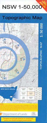
Mount Cemon 7930-S 1-50,000 scale NSW Topographical map is used for Walking, 4WD, Fishing, Camping, Motorcycle, both On and Off Road, Gold Prospecting and for those simply going for a family weekend drive.
Topographical maps show not only Contours of the Terrain but also Walking Tracks, Sealed and Unsealed Roads, Rivers, Creeks, Lakes, Historical Point of Interest, Old Mine Sites and National and State Park areas.
 We can Now LAMINATE and fold your map for $12.00. Just click on the image and add to the Trolley
NOW AVAILABLE PRINT ON DEMAND
1-50,000 scale NSW Topographical map is used for Walking, 4WD, Fishing, Camping, Motorcycle, both On and Off Road, Gold Prospecting and for those simply going for a family weekend drive.
Topographical maps show not only Contours of the Terrain but also Walking Tracks, Sealed and Unsealed Roads, Rivers, Creeks, Lakes, Historical Point of Interest, Old Mine Sites and National and State Park areas.
We can Now LAMINATE and fold your map for $12.00. Just click on the image and add to the Trolley
NOW AVAILABLE PRINT ON DEMAND
Locations within this Map
Thurlo The Rise Oakleigh Hopefield Mc Kinley Shiloh Neobine Gunbar Craigielea Gunbar Farm Crover East Glencoe Old Gunbar Wongalea Kelvin Grove Honuna Amoilla North Big Ben Creek Big Pegga Mulla Swamp Black Stump Swamp Black Stump Tank Bouyaree Creek Cabbage Garden Creek Mount Cemon Chirnside Coowerrawine Dead Horse Swamp Eurella Garowie Swamp Lake Gunbar Honuna North Hopwood Cabbage Garden or Boujaree Creek Mckinley Muckerumba Swamp Mulla Mulla Neds Lake Old Gumbar Well Old Gunbar Tank Pegga Mulla Swamp Queel Queel Gums Russell The Long Box Tippings Swamp Bullocks Head Swamp Bouyaree or Cabbage Garden Creek McKinley Grover
| Name: | Mount Cemon |
| Publisher: | New South Wales Government |
| Scale: | 1:50000 |
| Latitude Range: | 33° 45.0′ S – 34° 0.0′ S |
| Longitude Range: | 145° 0.0′ E – 145° 30.0′ E |
| Datum: | GDA 94 |