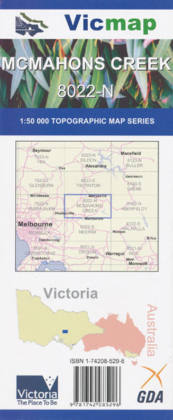
McMahons Creek 1-50,000 Vicmap
$12.00 – $26.00
Description:
McMahons Creek 1-50,000 scale Victorian Topographical map 8022N is used for Walking, 4WD, Fishing, Camping, Motorcycle, both On and Off Road, Gold Prospecting and for those simply going for a family weekend drive.
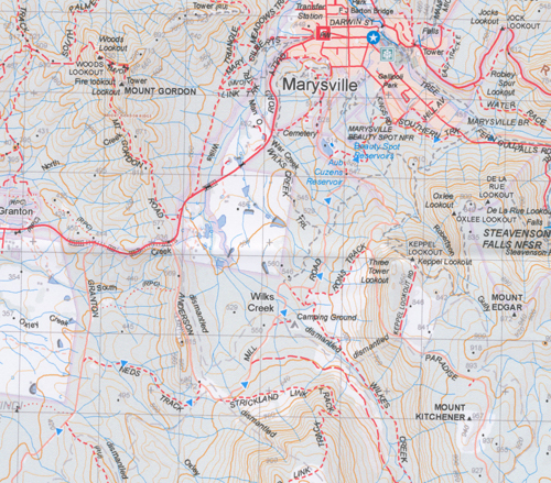
Topographical maps show not only Contours of the Terrain but Walking Tracks, Sealed and Unsealed Roads, Rivers, Creeks, Lakes, Historical Point of Interest, Old Mine Sites and both National and State Park areas.
Main Features of this map includes:
The Bicentennial Trail Track from Healesville to Keppel Falls
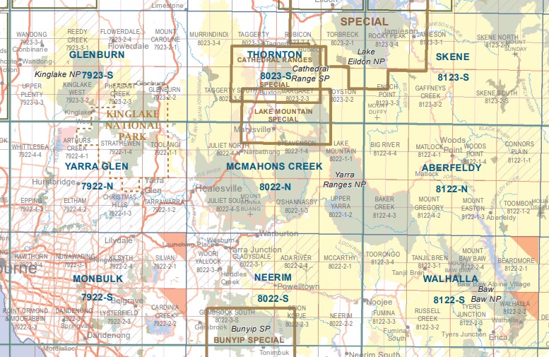
Coverage from Healesville to Upper Yarra Dam, Lake Mountain
Warburton to Marysville, Parts of the Rubicon and Big River State Forests, Mount Dom Dom, Steavenson Falls, Granton and McMahons Creek, Yarra Ranges National Park, Deep Creek Reference Area, Fernshaw, Mount Toolebewong Stae Forest, Mt Donna Buang, Mt Tanglefoot, Mount Saint Leonard, Mount Murrindindi, Midway Knob, Mount Morgan, Steavenson Falls, Mount Edgar, Depp Creek Reference Area, O’Shannassy River Catchment and Reservoir, Narbethong, Mount Boobyalla, Mount Sammy, Mount Donna Buang, Mount Juliet, Mount Vinagar, Strickland Spur, Mount Observation, Cumberland Falls, Mount Arnold, Mount Gordon, Mount Riddell, mbtg,, Marysville, Michaeldene Trestle Track, Steavenson River and Falls, Mount Edgar, Mount Kitchener, Deep Creek Reference Area, Mount Stinton, MBTG, Mount Grant, Tommy Bend Spur, Bingley View, Phantom Falls, Keppell Falls, Lake Mountain, Mount Arnold, O’Shannassy River Natural Catchment Area, Cumberland Falls, Mount Observation, Cambarville, Mount Morgan, Merrie Junction, Evelyn Falls, Messmate Saddle and Knob, Stockmans Spur, O’Shannassy Reservoir, Upper Yarra Reservoir , O’Shannassy River Natural Catchment Area, Mount Ritchie, McMahons Creek, Reefton, Armstrong Creek Weir, Upper Yarra Dam
Marysville, Mount Tanglefoot, Mount Saint Leonard, Siberia Junction, Saint Fillans, Narbethong, Mount Dom Dom, Dom Dom Saddle, Archer Lookout, Mount Strickland, Silvia Falls and Cascades, Toolangi State Forest, Corrigans Cascades, Bingley View, Meyers Creek Falls, CONDONS Track, the very north of Maroondah Reservoir, Mathinna Falls, Mount Monda mbtg, Camp Spur, MOUNT MURRINDINDI, Black Range State Forest, Fernshaw, Carters Gap, Mount Gordon, Granton Gap, Acheron River, Marysville State Forest, Feiglins Bridge, OShannassy River Natural Catchment Area, Wilks Creek, Keppel Lookout, Three Tower Lookout, Andersons Mill Camping Ground, mbtg, Mt Donna Buang, Healesville, Maroondah Reservoir, parts of the Yarra Ranges National Park, Mount Riddell, Mount Victoria, Ben Cairn, Mount Toole Be Wong, Mount Toolobowong, East Warburton, Yarra River, northern part of Warburton, Mount Boobyalla
You may also like…
-
Walhalla 1-50,000 Vicmap
$12.00 – $24.00Select options This product has multiple variants. The options may be chosen on the product page -
Juliet South 1-25,000 Vicmap Topographical map 80224S
$14.00 – $26.00Select options This product has multiple variants. The options may be chosen on the product page -
McMahons Creek South 1-25,000 Topographic Vicmap 8022-1-S
$14.00 – $26.00Select options This product has multiple variants. The options may be chosen on the product page -
Neerim 1-50,000 Vicmap
$12.00 – $26.00Select options This product has multiple variants. The options may be chosen on the product page -
Thornton 1-50,000 Vicmap
$12.00 – $24.00Select options This product has multiple variants. The options may be chosen on the product page -
Juliet North 1-25,000 Vicmap Topographic Map
$12.00 – $26.00Select options This product has multiple variants. The options may be chosen on the product page -
Aberfeldy 1-50,000 Vicmap
$12.00 – $24.00Select options This product has multiple variants. The options may be chosen on the product page -
Glenburn 1-50,000 Vicmap
$12.00 – $24.00Select options This product has multiple variants. The options may be chosen on the product page -
Monbulk 1-50,000 Vicmap
$12.00 – $24.00Select options This product has multiple variants. The options may be chosen on the product page -
Yarra Glen 1-50,000 Vicmap
$12.00 – $24.00Select options This product has multiple variants. The options may be chosen on the product page -
Skene 1-50,000 Vicmap
$12.00 – $24.00Select options This product has multiple variants. The options may be chosen on the product page -
MCMAHONS CREEK NORTH 1-25,000 Vicmap Topographic Map 8022-1-N
$14.00 – $26.00Select options This product has multiple variants. The options may be chosen on the product page


