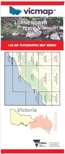
LORNE NORTH 1-25,000 Vicmap Topographic Map 7620-1-N
$14.00 – $26.00
Description:
LORNE NORTH 1-25,000 Vicmap Topographic Map 76201N Now Print On Demand is used for Walking, 4WD, Fishing, Camping, Motorcycle, both On and Off Road, Gold Prospecting and for those simply going for a family weekend drive.
This is a new series of 1-25,000 scale maps, all of Victoria is now covered by these maps, including maps over the South Australian and NSW Borders.
Topographical maps show not only Contours of the Terrain but Walking Tracks, Sealed and Unsealed Roads, Rivers, Creeks, Lakes, Historical Points of Interest, Old Mine Sites mbtg and National and State Park areas.
Main Features of this map includes:
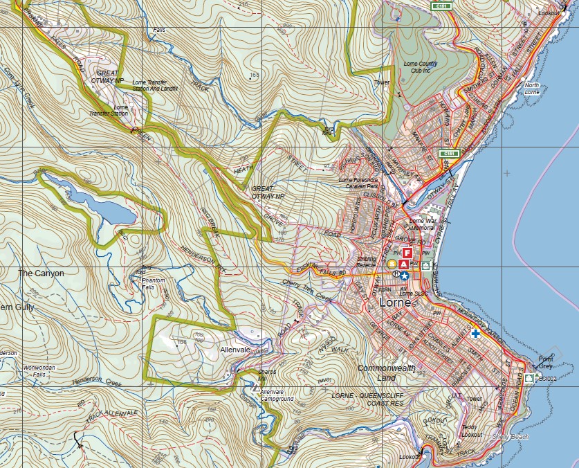
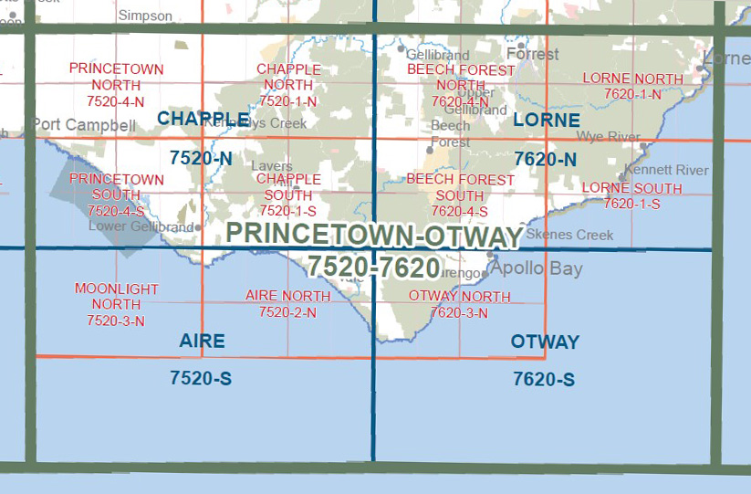
Covers the old series maps Lorne and Mount Cowley
Lorne, Lorne Queenscliffe Coast, Defiance Falls, Artillery Rocks Lookout, Jamieson Camping Area, Jamieson Track, Godfrey Track, Great Ocean Road, The Brothers, Sheoak Track, Castle Rock, Langdale Pike, Mount Sain George, The Canyon, Mount Defiance, Haines Ridge, Kyles Falls, Erskins Falls, Margaret Falls, mbtg, Mt Cowley, Cowley Track, Middle Spur, Henderson Falls, Cumberland Falls, Ricketts Clearning, Curtis Clearing, Lower Kalimna Falls, Wannathan Falls & Cascade, Upper Cumberland Falls, Galliebarinda Falls, Kennett Spur, Upper Kalimna Falls, Garvey Clearing, Mackie Creek.
You may also like…
-
Otways Walking Maps Spatial Vision 3 Map Set
$39.00 – $69.00Select options This product has multiple variants. The options may be chosen on the product page -
Princetown Otways 1-100,000 Vicmap Topographic Map 7520 7620
$12.00 – $24.00Select options This product has multiple variants. The options may be chosen on the product page -
Lorne 1-50,000 Vicmap
$12.00 – $24.00Select options This product has multiple variants. The options may be chosen on the product page -
LORNE SOUTH 1-25,000 Vicmap Topographic Map 7620-1-S
$14.00 – $26.00Select options This product has multiple variants. The options may be chosen on the product page