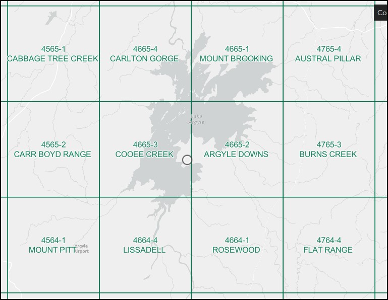
Lissadell 1-50000 Topographic Map 4664-4 WA
$15.95 – $26.95
Description:
Lissadell 1-50000 Topographic Map 4664-4 WA Print on Demand
Southyern section of Lake Argyle
Locations within this Map
Bloodwood Creek Bloodwood Yard Bow River Bow River Mine Cooee Creek Dicks Creek Dicks Yard Dry Creek Evelyn Range Kurrajong Creek Lagoon Creek Limestone Creek Lissadell Lissadell Station Landing Ground Little Limestone Creek Mckenna Spring Well Mount Evelyn New Discovery Yard No. 1 Bore No. 16 Bore No. 2 Bore No. 5 Bore No. 7 Bore No. 8 Bore Pear Creek Smoke Creek Spring Creek
| Name: | Lissadell |
| Publisher: | Geoscience Australia (Australian Government) |
| Scale: | 1:50000 |
| Latitude Range: | 16° 30.0′ S – 16° 45.0′ S |
| Longitude Range: | 128° 30.0′ E – 128° 45.0′ E |
| Projection / Datum: | Universal Transverse Mercator, GDA94 or WGS84 |
| Approx Print Size: | 0.56m X 0.56m |
| Publication Date: | 1-Jun-92 |
Read More
You may also like…
-
Mount Brooking 1-50000 Topographic Map 4665-1 WA
$14.95 – $26.95Select options This product has multiple variants. The options may be chosen on the product page -
Carlton Gorge 1-50000 Topographic Map 4665-4 WA
$14.95 – $26.95Select options This product has multiple variants. The options may be chosen on the product page -
Argyle Downs 1-50000 Topographic Map 4665-2 WA
$14.95 – $26.95Select options This product has multiple variants. The options may be chosen on the product page -
Lissadell 1-250,000 Topographic Map
$15.95 – $27.95Select options This product has multiple variants. The options may be chosen on the product page -
Cooee Creek 1-50000 Topographic Map 4665-3 WA
$14.95 – $26.95Select options This product has multiple variants. The options may be chosen on the product page


