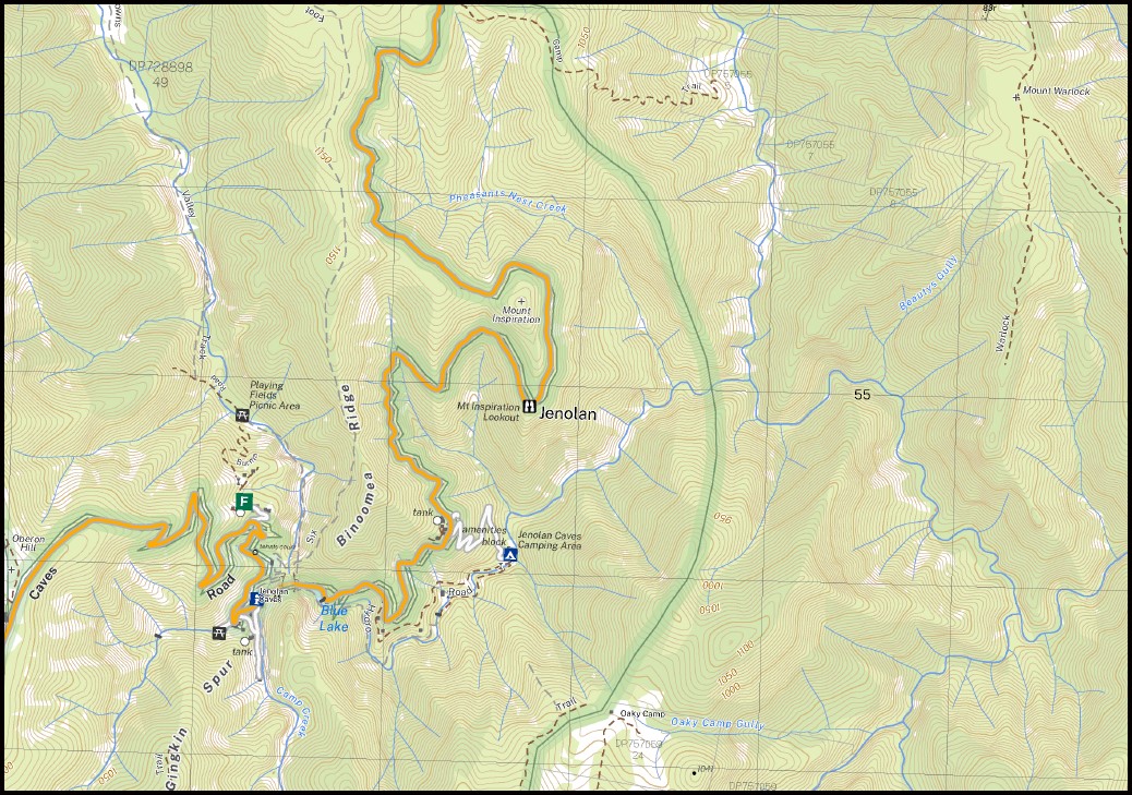
Jenolan 1-25,000 NSW Topographic Map
$16.95 – $28.95
Description:
Jenolan 1-25,000 NSW Topographic Map Print on Demand 8930-3-N
Sunny Ridge Barrymore Mountain View Caves House Alala Creek Alala East Gully Alala West Gully Bad Dog Gully Mount Bailey Beautys Gully Beefsteak Creek Bees Nest Creek Bees Nest Ridge Bees Nest Spur Bellbird Point Bellbird Ridge Biddys Creek Big Oaky Creek Blue Pup Spur Blue Dog Range Blue Dog Ridge Blue Dog Spur Blue Dog Buttress Black Range Black Jerrys Black Jerrys Ridge Blackhorse Gap Blackhorse Mountain Blackhorse Range Black Horse Ridge Black Horse Creek Blood Filly Creek Black Harry Glen Black Harry Gully Black Glen Black Dog Creek Black Creek Blackbutt Gully Binoomea Binoomea Ridge Bindo Caves Binda Caves Breakfast Creek Brindle Dog Creek Brindle Dog Range Brindle Dog Ridge Brindle Pup Gully Brindle Pup Ridge Brown Dog Gully Brumby Glen Brumby Gully Camp Creek Cams Creek Cams Ridge Carlon Creek Cattle Dog Ridge Cookes Gully Council Creek Crandon Falls Cronje Gully Cronje Mountain Cronje Ridge Mount Cullen Mount Dunn Dwyer Creek Mount Edwards Faithful Hound Gully Faithful Hound Ridge Five Mile Ridge Flaggi Clear Galong Creek Galong Hill Gasper Buttress Gasper Creek Gasper Gully Ghost Dogs Gully Gingkin Spur Goolara Gully Goolara Peak Grand Bluffs Green Gully Green Ribbon Hill Gubba Gully Guouogang Brook Guouogang Creek Guouogang Pit Hawk Fell Heartbreaker Buttress Mount Heartbreaker Hellcat Throne Mountain Hellgate Gorge Hollanders Creek Howling Dog Gully Howling Dog Ridge Mount Inspiration Ironmonger Gully Ironmonger Hill Ironmonger Spur Ironpot Gully Ironpot Mountain Ironpot Ridge Island Hill Jenolan Jenolan Buttress Jenolan Caves Jenolan Caves Public School Mount Jenolan Jenolan River Jerrys Gully Jigger Gully Katoomba View Kennel Flat Cams Spur Cattle Dog Mountain Clwydd Valley Cronje Buttress Cronje Glen Mount Cullin Fish River Caves Five Mile Hill Gasper East Gully Gasper West Gully Gingkin Point Glenalan Creek Glenraphael Creek Grand Faults Gubba Glen Harrys River Hellcat Throne Hellgate Canyon The Ironmonger The Island Jerrys Creek Jigger Creek Kiaora Hill Knights Deck Konangaroo Krungle Bungle Range Mount Lakeman Little Dingo Gully Little Dingo Hill Little Dingo Ridge Little River Lower Canyon Lower Jenolan Canyon Lower Jenolan Gorge Mount Luther Lyrebird Point Lyrebird Ridge Mcaviney Gully Mount Mcaviney Mckeons Caves Mckeons Creek Mckeons Creek Left Hand Branch Mckewens Caves Mary Green Place Merrigal Creek Merrigal Gully Merrimerrigal Mount Merrimerrigal Mobbs Swamp Moorara Boss Moorara Buttress Moorara Mountain Moorara Range Moorara Spur Mouin Mount Mouin Mumbedah Creek Murphy Reserve Navies Creek Ngira-Nganggala Gully North Blue Pup Nortons Gully Oaky Camp Oaky Camp Creek Oaky Camp Gully Oberon Hill Mount O’Reilly Pass Gully The Pass Creek Pheasants Nest Creek Pine Plantation Queahgong Buttress Queahgong Creek Mount Queahgong Queahgong Pit Quartpot Gully Round Mount Round Mount Creek Sassafras Creek Scrubbers Hump Sharptooth Gully Slaughterhouse Creek Slaughterhouse Gully Slithery Bull Creek Slithery Bull Gully South Blue Pup South Jenolan South Jenolan Caves Splendour Rock Spotted Dog Ridge Spotted Dog Ridge East Spotted Dog Ridge North Spring Creek Spring Gully Springs Gully Stanhope Creek Stockyard Creek Surveyors Creek Sweet Ridge Creek Tarpot Creek Tarpot Gully Terrace Creek Mount Thomas Jones Tinpot Creek Tinpot Hill Tin Pot Hill Tinpot Mountain Wallaroo Point Mount Warlock Warlock Ridge Warrigal Gap Warrigal Gully Mount Warrigal West Jenolan Caves Whipcrack Hill Whipcrack Spur Mount Whiteley Mount Wiburd Wombat Creek Diable Ridge Dingo Creek Dingo Gap Mount Dingo Yellow Dog Creek Yellow Dog Point Mount Yellow Dog Yellow Dog Range Yellow Dog Ridge Yellow Pup Gully Yellow Pup Ridge Bulls Creek Diable Creek Diable Pit
| Name: | Jenolan |
| Publisher: | New South Wales Government |
| Scale: | 1:25000 |
| Latitude Range: | 33° 45.0′ S – 33° 52.5′ S |
| Longitude Range: | 150° 0.0′ E – 150° 15.0′ E |
| Datum: | GDA 2020
Edition 2022 |
You may also like…
-
Katoomba 1-25,000 NSW Topographic Map
$16.95 – $28.95Select options This product has multiple variants. The options may be chosen on the product page -
Blue Mountains North and South Maps Spatial Vision
$30.00 – $60.00Select options This product has multiple variants. The options may be chosen on the product page -
Hampton 1-25,000 NSW Topographic Map
$16.95 – $28.95Select options This product has multiple variants. The options may be chosen on the product page -
Blue Mountains North Map Spatial Vision
$19.95 – $29.95Select options This product has multiple variants. The options may be chosen on the product page -
Blue Mountains South Map Spatial Vision
$19.95 – $29.95Select options This product has multiple variants. The options may be chosen on the product page


