Jamison 1-25,000 NSW Topographic Map
$16.95 – $31.95
Description:
8930-2-N Now Print on Demand
Jamison 1-25,000 scale NSW Topographical map 89302N is used for Walking, 4WD, Fishing, Camping, Motorcycle, both On and Off Road, Gold Prospecting and for those simply going for a family weekend drive.
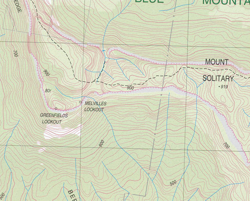
Topographical maps show not only Contours of the Terrain but also Walking Tracks, Sealed and Unsealed Roads, Rivers, Creeks, Lakes, Historical Point of Interest, Old Mine Sites and National and State Park areas.
Part of the Blue Mountains National Park
Erskine Range
Blue Labyrinth
Part of Lake Buragorang
Kedumbra Walls and Wild Dog Mountains
This map includes the following localities: Glendale Kiloran Kedumba Apple-Tree Flat Appletree Flat Basin Creek Battleship Tops Mount Bedford Bedford Creek Bedford Creek Lookdown Bedford Creek Lookout Bedford Ridge Berrima Inga Creek Berrima Inga Ridge Blue Labyrinth Blue Drum Creek Blue Drum Waterhole Black Pup Gully Black Pup Ridge Black Dog Ridge Black Dog Gorge Black Dog Range Black Dog Canyon Black Dog Chasm Black Billy Head Camp Cave Hill Carlon Head Cedar Creek Cedar Gap Cedar Head Cedar Head Swamp Cedarland Ridge Cedar Ridge Cedar Valley Cedar Valley Ridge Centre Mount Chinamans Gully Clear Hill Cookem Buttresses Mount Cookem Mount Debert Duncans Pass Dunphys Pass Erskine Creek State Forest Mount Erskine Erskine Range Euroka Fern Creek Fools Paradise Geeraganggala Creek Mount Gibson Glenalan Creek Glenalan Spurs Glenenid Gully Glen Erskine Glen Erskine Creek Glenmedlow Gully Glenraphael Falls Glenraphael Head Glenraphael Swamp Greenfields Lookout Green Gully Saddle Green Hills Ridge Grey Dog Ridge Grizzled Dog Ridge Growler Ridge Mount Hall Harris Creek Harris Hill Hayrick Hill Ingar Ingar Creek Jensens Dam John Seymour Hill Kedumba Hill Kedumba Pass Kedumba River Kedumba Valley Kedumba Walls Kelpie Hill Kelpie Point Cedar Canyon Buttress Cedarland Divide Centre Mountain The Col Debert Knob Devils Elbow East Mouin Gully Erskine Main Ridge Erskine River State Forest Glenenid Glenmedlow Greenfields Lookover The Green Hills Grey Dog Range Mount Harris Harris Mountain Mount Hayrick The Hayrick Katoomba Creek Kedumba Creek Mount Kedumba Kiara Creek Kills Defile Kills Head Kings Tableland Kirai Gorge Korrowall Buttress Korrowall Knife Edge Korrowall Ridge Lions Head Lions Head Ridge Little Cedar Creek Little Cedar Gap Little Mouin Gully Lowndes Ridge Massif Ridge Medlow Gap Melvilles Lookdown Melvilles Lookout Middle Mouin Gully Mitchells Creek Morriberri Buttress Morriberri Spur Mouin Mouin Creek Mountain The Mukku Baluru Bluff Mukku Baluru Point Narrow Neck Narrow Neck Peninsula Narrow Neck Plateau North Hill Notts Notts Hill Notts Ridge Notts Swamp Pearces Creek Pearces Mountain Policeman Point Policeman Range Policeman Ridge Queen Victoria Creek Rayfrandell Gully Red Dog Gully Red Dog Ridge Red Head Red Ridge Reedy Creek Point Repulse Rocky Knob Rocky Knob Ridge Rocky Knob Creek Rocky Knob Point Rucksack Point Rucksack Ridge Ruined castle Ruined Castle Gully Ruined Castle Ridge Sally Wattle Waterhole Sanatorium Second Narrow Neck Shaggy Dog Ridge Singajingawell Creek Sliprail Creek Snarling Dog Creek Snarling Dog Ridge Mount Solitary Solitary Pass South Hill Spring Creek Sublime Point Ridge Sunset Rock Lookout Taros Ladder Tarros Ladder The Massif Tollbar Creek Walls Pass Waratah Warrigal Gully Warrigal Hill Waterfall Creek West Hill Mount Whaite White Dog Creek White Dog Gully White Dog Range White Dog Ridge White Pup Points Wild Dog Mountains Williams Ridge Wollum Hill Diamond Creek Bunba Yaka Creek Bunba-Yaka Gully Double Hill Bushwalkers Hill Jamison Valley Hayes Crossing Mount Pelham
| Scale: | 1:25000 | ||||||||||
| Latitude Range: | 33 45.0 S – 33 52.5 S | ||||||||||
| Longitude Range: | 150 15.0 E – 150 30.0 E | ||||||||||
| Approx Print Size: | 0.56m X 1.11m | ||||||||||
| Projection: | Transverse Mercator
|


