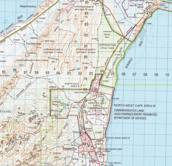
Exmouth 1-100,000 Topographic Map Geoscience Australia
$13.95 – $25.95
Description:
Exmouth 1-100,000 Topographic Map Geoscience Australia 1754 Now Print on Demand
Locations within this Map
Exmouth Harold E Holt Naval Communication Station 5 Mile Well Babjarrimannos Beryl Reef Brand Park Bundegi Coastal Park Bundegi Inner Reef Bundegi Outer Reef Chugori Rockhole Combe Reef Cullen Park Dailey Shoal Darcy Ridge Dunes Exmouth Boat Harbour Exmouth District High School Exmouth Golf Club Exmouth Hospital Exmouth Reef False Island Point Harold E Holt Naval Communications Stn Helby Bank Jims Beach Johnson Oval Jurabi Coastal Park Koobooroo Sports Oval Kuburu Well Laurance Retirement Village Lefroy Bicentennial Park Lighthouse Bay Lighthouse Hill Meredith Stephens Circuit Mount Athol Mowbowra Well Muiron Islands Niblett Oval North Muiron Island North West Cape North West Cape Light North West Reef Otway Reef Outtrim Patches Palms Well Paltridge Memorial Centre Pap Hill Payne Pass Pearl Reef Point Murat Rivoli Islands S.S. Mildura Wreck Snapper Park Somerville Island South Muiron Island Sunday Island Talanjee Oval The Bombie Tony Keenan Courts Torpedo Bay Tower Zero Town Beach Victor Island Vigilant Passage Vlamingh Head Vlamingh Head Lighthouse Vlf Bay WA2001 Federation Park Y Island Yardie Homestead Caravan Park Outrim Patches Sunday Islet Ningola Curinana Vlaming Head Point Murat Wharf Cape Well Paynes Pass Bundegi Reef Yardie Creek Kudumurra Well Neds Well Bare Hill Eva Island Eva Islet Kubura Well Mowbowra Creek
| Name: | Exmouth |
| Publisher: | Geoscience Australia (Australian Government) |
| Scale: | 1:100000 |
| Latitude Range: | 21° 30.0′ S – 22° 0.0′ S |
| Longitude Range: | 114° 0.0′ E – 114° 30.0′ E |
| Projection / Datum: | Universal Transverse Mercator, GDA94 |
| Approx Print Size: | 0.56m X 0.56m |
| Publication Date: | 2004 |


