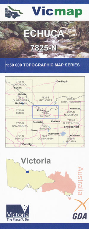
Echuca 1-50,000 Vicmap
$12.00 – $24.00
Description:
Echuca 1-50,000 scale Vicmap Topographical map 7825N is used for Walking, 4WD, Fishing, Camping, Motorcycle, both On and Off Road, Gold Prospecting and for those simply going for a family weekend drive.
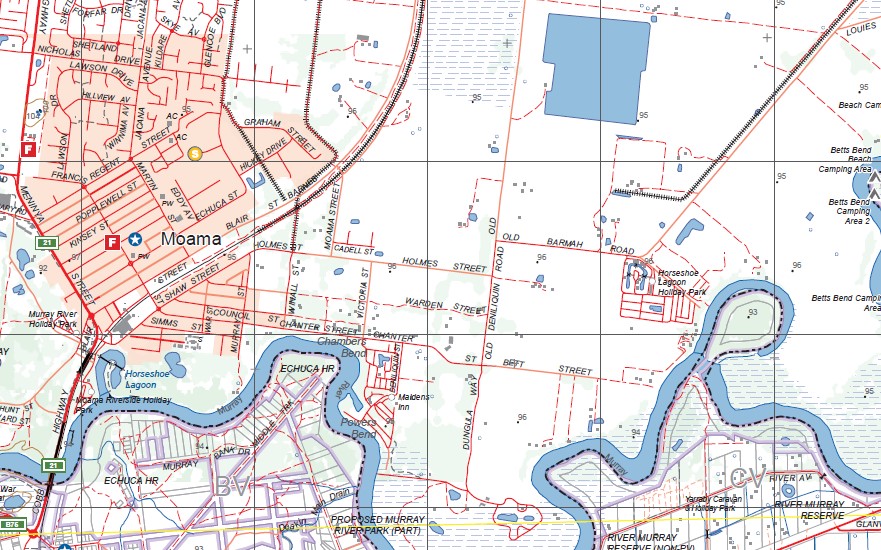
Topographical maps show not only Contours of the Terrain but Walking Tracks, Sealed and Unsealed Roads, Rivers, Creeks, Lakes, Historical Point of Interest, Old Mine Sites mbtg and National and State Park areas.
Main Features of this map include:
The towns of Echuca, Moama, Barmah, Torrumbarry, The Murray River, Goulburn River and Campaspie River
Barmah, Kanyapella, Moama, River Murray Reserve, Barmah Island South, The Ranch Sites 1 to 7, part of Murray River, Kiln Loop Track Camping Area, Echuca RP, part of Lower Goulburn NP, Morning Glory River Resort, mbtg, Lower Moira, Madowla Park Airfield, Waites Lane Camping Area, Stewarts Bridge Camping Area, Simmie Road Camping Area, Snagging Track Camping Area, Yambuna Track Camping Area, McKerrow Bend Camping Area, Beattie Depression Floodway, Echuca Historic Region, mbtg, Echuca, part of the Murray River, Kanyapella, Barep, Barooga Road Bridge, Bringenbrong Bridge, Yambuna, edge of Lower Goulburn National Park, Yambuna Creek, mbtg, Kanyapella Water Authority Land, Beattie Depression Floodway, Echuca Airfield, Bay of Biscay Bridge, Kanyapella South, Koyuga, Tongala, Yarraby Caravan & Holiday Park, Mckerrow Bend Camping Area, Rich River Tourist Park, Campaspe Park Raceway, Yarraby Caravan & Holiday Park, Yambuna Bridge
Torrumbarry, Wharparilla North, River Murray Reserve, Barra Bend Camping Area, Tolhurst Bend Camping Area, Benarca Waterholes, Baillieu Lagoon, mbtg, part of Terrick Terrick National Park, Turrumberry North BR, Weaning Point, Burnanga Bend, Braund Bend Camping Area 1-3, Pianta Bend Camping Area 1-5, Crossman Bend Camping Area 1 and 2, Young Bend Camping Area 1 and 2, Barra Bend Camping Area 1and 2, Tolhurst Bend Camping Area 1 and 2, Baillieu Bend Camping Area 1-2-3 and 4, Arnold Bend Camping Area, Betha Bend Site 1 and 2, Farley Bend Site 1-9, Weaning Point, Osullivan Road Site 1, Emu Bend Site 1, Wills Camp Site 1-5, Casey Bend Site 1 and 2, Riverlander Caravan Park, Burnanga Bend Site 1-4, A Shady River Holiday Park, Echuca
Holiday Park, Halls Rest Area, PATHO PLAINS RAILWAY NCR, Merool On The Murray, mbtg, Wharparilla, Patho Plains Railway NCR, part of Terrick Terrick National Park, Pipit NCR, part of Echuca township, mbtg, Mystery Lake, Little Kotta NCR, Echuca West, Kotta Airfield, part of the Campaspse River, Kotta, Roslynmead, CANTWELL NCR, Bamawm Extension
You may also like…
-
ECHUCA SOUTH 1-25,000 Vicmap Topographic Map 7825-1-S
$14.00 – $26.00Select options This product has multiple variants. The options may be chosen on the product page -
WHARPARILLA NORTH 1-25,000 Vicmap Topographic Map 7825-4-N
$14.00 – $26.00Select options This product has multiple variants. The options may be chosen on the product page -
WHARPARILLA SOUTH 1-25,000 Vicmap Topographic Map 7825-4-S
$14.00 – $26.00Select options This product has multiple variants. The options may be chosen on the product page -
ECHUCA NORTH 1-25,000 Vicmap Topographic Map 7825-1-N
$14.00 – $26.00Select options This product has multiple variants. The options may be chosen on the product page -
Strathmerton 1-50,000 Vicmap
$12.00 – $24.00Select options This product has multiple variants. The options may be chosen on the product page -
Cohuna Echuca Gunbower Map Hayman
$12.95 – $25.00Select options This product has multiple variants. The options may be chosen on the product page -
Gunbower 1-50,000 Vicmap
$12.00 – $24.00Select options This product has multiple variants. The options may be chosen on the product page


