Early Navigators of Bass Strait 1770 – 1803 Poster Large
$50.00 – $70.00
Description:
Early Navigators of Bass Strait 1770 – 1803 Flat Poster, Paper and Laminated
Size 2100mm x 825mm
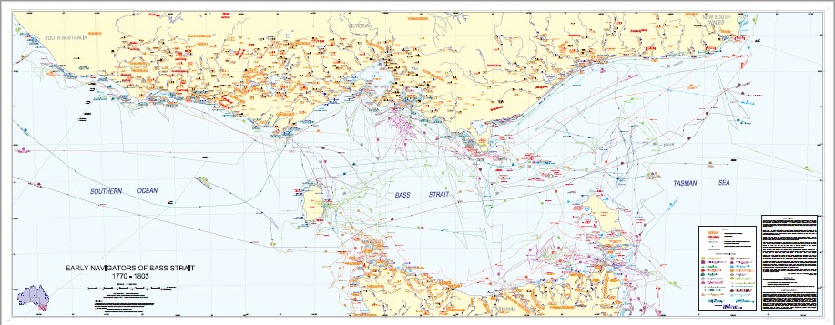
| Scale | Scale 1:500,000 [1 cm. = 5 km.] Lambert Conformal Conic. proj. E 139°40’00–E 151°20’00/S 37°10’00–S 41°25’00 |
|---|---|
| Description | [Melbourne] : State of Victoria, Department of Sustainability and Environment, c2010 Size 2100 x 825cm . |
| Full contents |
|
| Biography/History |
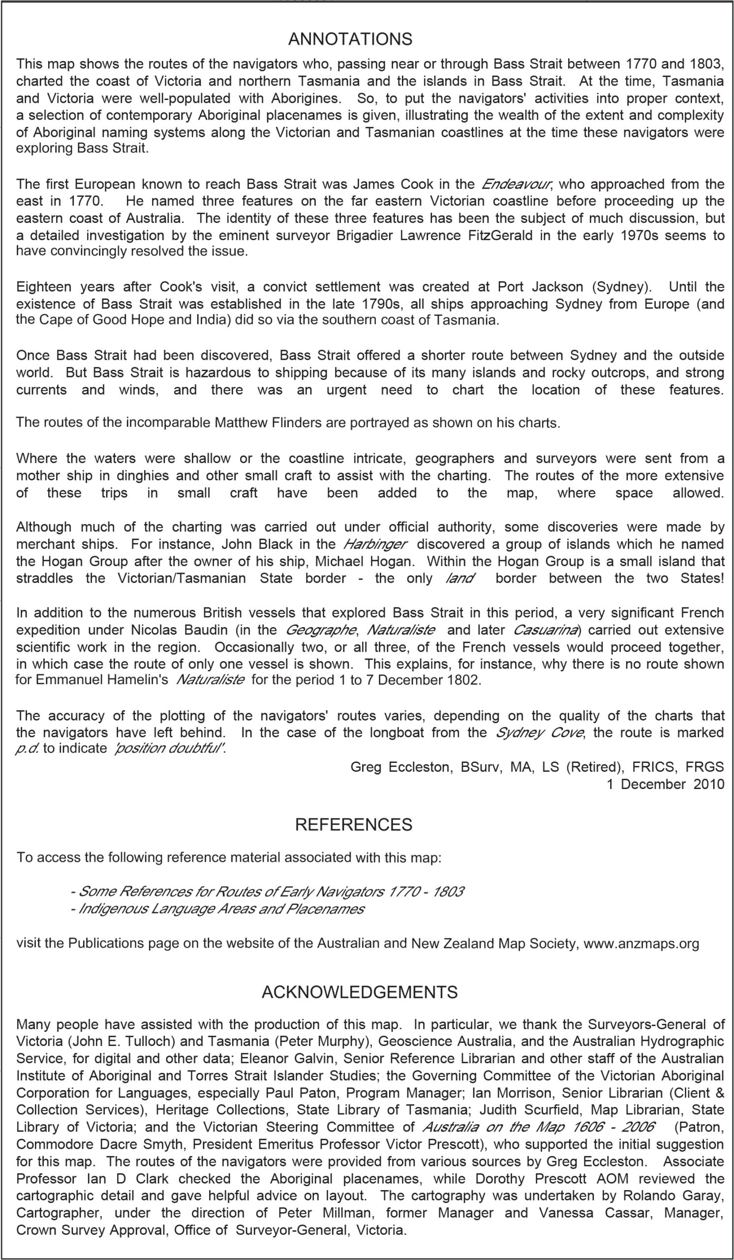
Background: proposed in 2004, the map was developed over a period of five years (2005-2010) to celebrate the 400th anniversary of the first known charting of part of the western coastline of Cape York Peninsula, Queensland by Willem Janszoon in the Duyfken (1606). Each Australian state and territory was encouraged by the “Australia on the Map 1606-2006” (AOTM) organisation to celebrate the charting of its own coastline. |
| Notes |
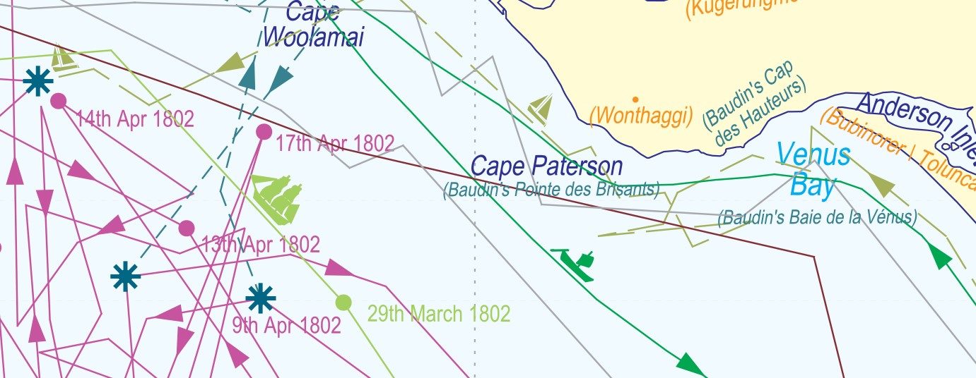
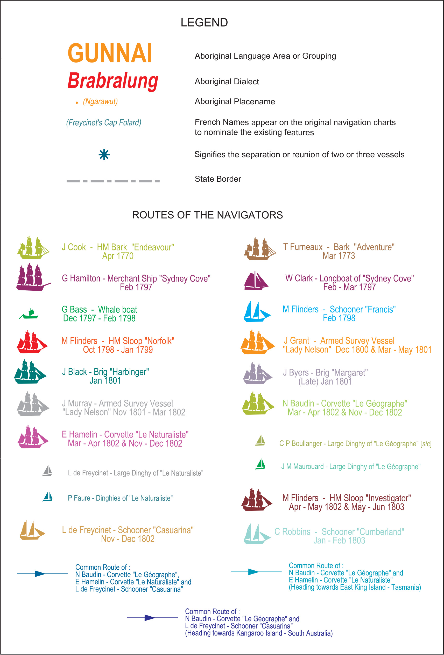
Relief not shown. Map won the Judge’s Special Prize for Excellence at the Royal Historical Society of Victoria’s 2011 Victorian Community History Awards in October 2011. Includes index and references to accompany student activities. Map “shows the route of the [European] navigators who were passing near or through Bass Strait between 1770 and 1803 …”. Nautical chart of Bass Strait with the southern coastline of Victoria, King Island, southern part of South Australia up to Rivoli Bay, northern coastline of Tasmania and the islands of Bass Strait. Map includes a “selection of contemporary Aboriginal” language area, dialect and place names. Cartography team led by Rolando Garay of the Victorian Surveyor-General’s Department, with research by Greg Eccleston, a retired surveyor. |