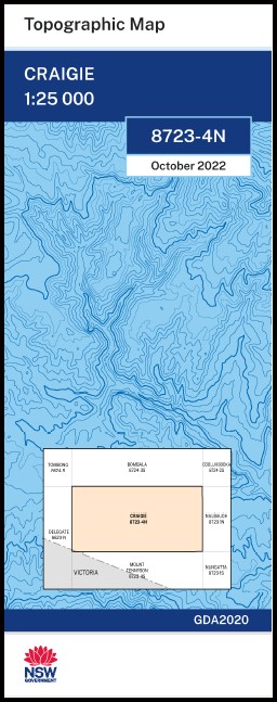

Craigie 1-25,000 NSW Topographic Map
$16.95
Description:
Craigie 1-25,000 NSW Topographic Map 8723-4-N Now Print on Demand Map Printed
Cragie 1-25,000 Scale NSW Topographical Map is used for Walking, 4WD, Fishing, Camping, Motorcycle, both On and Off Road, Gold Prospecting and for those simply going for a family weekend drive.
Topographical maps show not only Contours of the Terrain but also Walking Tracks, Sealed and Unsealed Roads, Rivers, Creeks, Lakes, Historical Point of Interest, Old Mine Sites and National and State Park areas.
This map includes the following localities: Bendock River Benjamin Flat Black Bobs Creek Bimmel Creek Boundary Creek Boundary Gully Bourkes Creek Brownlie Camerons Creek Camerons Ridge Chinamans Creek Craigie Craigie Bog Creek Davidsons Creek Deep Creek Five Mile Creek Glen Beattie Creek Gulgin Flat Hayden Ila Creek Irondoon Range Camerons Hill Camping Ground Gully Lawson Creek Linden Greek Little Plains River Mila Pipeclay Spring Quinburra Big Bog Rock Flat Rock Flat Creek Rocky Waterholes Creek Ryans Creek Sandy Creek Scotts Flat Springs Creek Station Gully Target Rock Ten Chain Creek Ten Chain Gully Tombola Creek Tombola Flat Tooraloo Point Velts Creek Velts Gully Whites Spring Creek Wild Horse Gully Woolshed Creek Duguids Bog Duguids Ridge Duguids Range Burnt Hut Creek Craigie State Forest Nalbaugh Flora Reserve
| Scale: | 1:25,000 |
| Latitude Range: | 37 00.0 S – 37 07.5 S |
| Longitude Range: | 149 00.0 E – 149 15.0 E |
| Approx Print Size: | 0.56m X 1.11m |
| Projection: | Transverse Mercator
GDA 2020 Edition 2022 |
You may also like…
-
Mount Tennyson 1-25,000 NSW Topographic Map
$16.95 – $31.95Select options This product has multiple variants. The options may be chosen on the product page -
Nungatta 1-25,000 NSW Topographic Map
$16.95 – $28.95Select options This product has multiple variants. The options may be chosen on the product page -
Nalbaugh 1-25,000 NSW Topographic Map
$16.95 – $31.95Select options This product has multiple variants. The options may be chosen on the product page -
Yambulla 1-25,000 NSW Topographic Map
$16.95 – $28.95Select options This product has multiple variants. The options may be chosen on the product page -
Wangarabell 1-50,000 Vicmap
$12.00 – $24.00Select options This product has multiple variants. The options may be chosen on the product page -
CRAIGIE NORTH 1-25,000 Vicmap Topographic Map 8723-4-N
$14.00 – $26.00Select options This product has multiple variants. The options may be chosen on the product page -
CRAIGIE SOUTH 1-25,000 Vicmap Topographic Map 8723-4-S
$14.00 – $26.00Select options This product has multiple variants. The options may be chosen on the product page -
Nungatta 1-50,000 Vicmap
$12.00 – $24.00Select options This product has multiple variants. The options may be chosen on the product page -
Bemboka 1-25,000 NSW Topographic Map
$16.95 – $28.95Select options This product has multiple variants. The options may be chosen on the product page