
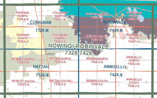
COLIGNAN NORTH 1-25,000 Vicmap Topographic Map 7328-1-N
$14.00 – $26.00
Description:
COLIGNAN NORTH 1-25,000 Vicmap Topographic Map 7328-1-N Now Print On Demand is used for Walking, 4WD, Fishing, Camping, Motorcycle, both On and Off Road, Gold Prospecting and for those simply going for a family weekend drive.
This is a new series of 1-25,000 scale maps, all sections of Victoria are now covered by these maps, including maps over the South Australian and NSW Borders.
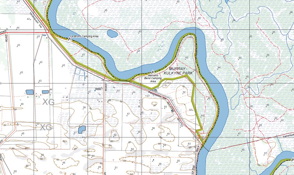
Topographical maps show not only Contours of the Terrain but Walking Tracks, Sealed and Unsealed Roads, Rivers, Creeks, Lakes, Historical Points of Interest, Old Mine Sites, mbtg and National and State Park areas.
Main Features of this map includes:
Colignan, Kulkyne, part of Murray River Reserve, Bengallow Creek, part of Murray-Kulkyne Park, Mansells Bend Camping Area, Le Bruns Camping Area, Graces Bend Camping Area, Emmerts Bend Camping Area, mbtg, Tarpaulin Bend Reference Area (no public access), Britts Bend Camping Area, Tarpaulin Bend Camping Area, Goosefoot Track, part of Hattah-Kulkyne National Park, Lake Boolca, Station Bend Camping Area, Horseshoe Billabong.
You may also like…
-
Hattah Kulkyne Map Guide Map Meridian
$10.95 – $19.95Select options This product has multiple variants. The options may be chosen on the product page -
COLIGNAN SOUTH 1-25,000 Vicmap Topographic Map 7328-1-S
$14.00 – $26.00Select options This product has multiple variants. The options may be chosen on the product page -
Colignan 1-50,000 Vicmap
$12.00 – $24.00Select options This product has multiple variants. The options may be chosen on the product page -
Hattah 1-50,000 Vicmap
$12.00 – $24.00Select options This product has multiple variants. The options may be chosen on the product page