Clermont 1-250,000 Topographic Map
$15.95 – $30.95
Description:
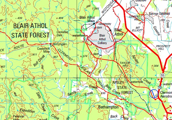
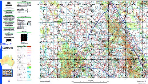
This 1-250,000 topographic map is part of the series that covers the whole of Australia at a scale of 1:250 000 (1cm on a map represents 2.5 km on the ground) and comprises 513 maps. This is the largest scale at which published topographic maps cover the entire continent. Each standard map covers an area of 1.5 degrees longitude by 1 degree latitude or about 150 kilometres from east to west and 110 kilometres from north to south. There are about 50 special maps in the series and these maps cover a non-standard area. Typically, where a map produced on standard sheet lines is largely ocean it is combined with its landward neighbour. These maps contain natural and constructed features including road and rail infrastructure, vegetation, hydrography, contours (interval 50m), localities and some administrative boundaries. The topographic map and data index shows coverage of the sheets. Product Specifications Coverage: The series covers the whole of Australia with 513 maps. Currency: Ranges from 1995 to 2009. 95 of maps have a reliability date of 1994 or later. Coordinates: Geographical and either AMG or MGA (post-1993) Datum: AGD66, GDA94, AHD. Projection: Universal Traverse Mercator (UTM) Medium: Paper, flat and folded copies.
Charlton Park Mt Lebanon Golden Downs Solferino Wondabah Iffley Moramana Mazeppa Park Mount Wilkin Wondabah South Boolaroo Ripstone Paradise Downs Aroa Windradene Calveston Travellon Ellenor Downs Olive Downs Brolga Park Rugby Winchester Downs Vicenza Kenmar Deverill Gudgee Park Carmel Downs Skyville Stud Durdham Manar Glenelgin Glenlea Terra Maria Barcombe Kilcummin Kiandra Logan Creek Kenlogan Talki Dooruna Well Plains Diamond West Morambah Wyena Grosvenor Downs Laurel Hills Diamond Downs Daunia Willeslay Amaroo Coolibah Downs Poitrel Logan Downs Saraji Colin Downs Yackadoo Undara Downs Russell Park Jimbaroo Downs Cairo Kilmacolm Coovin Green Hills Logan Downs East Mutation Palmyra Hyland Downs Tiggabon Gunnadoo Niagara Fletchers Awl Winvic West Wolfang Gemini Downs Vermont Curraweena Charlton Bendemere Merriwonga Wandina Souths Tay Glen Kywong Greenmantle Luxor Coolibah Kalang Glenmore Downs Peak View Mooramin Miclere Currogundi Littledale Kurrajong Kinsale Monteagle Abilene Mount Hillary Wallton Wongajong Cotherstone Dysart Station Picardy Yankee Bradford Stud Black Ridge New Corry Table View Muidart Stephens Creek New Blair Athol Blair Athol Morbridge Glenmore Fairfield Innisfree Bungarra Telerah Table Downs Hihgland Plains Araluen Barrylar Teecedale Homeliegh Orana Pethula Norwich Park Recruit Wolfang Huntley Huntly Birimgan Grenda Pioneer Moorlands Native Bee The Venus Fleurs Old Corry Waterford Bundeleer Camden Park Mount Oscar Penaddi Abor Downs Colorado Shalom Langfield Lindleigh Bluegrass Plains Gaylong New Banchory Ironbark Lankton Cottage Salt Springs Elenora Dalkieth Gibson Downs Booroondara Paringa Mount Roper Hazeldene Weimbi Downs Boonal Downs Clydevale Retro Eurimie Redrock Langton Downs Torrendorra Craigywarren Lowestoft Lillyvale Dakota Dawnside Wilmore Downs Coomburragee Hillview Brewery Farm Mountain View Caramar Dorlynden Downs Marathon Neelia Kalora Weemabah Peak Downs Mount Lowe Nanya Landsdowne Marylands Greendale Woollamba Bellevue Valencia Nine Mile Talarah Yungaba Magenta Sunny Park Belcong Clermont Dysart Anvil Peak Apsley Apsley Creek Aroa Water Facility Apsley State Forest Back Creek Banchory Barrett Creek Bath Creek Bathampton Beacon Hill Bell Camp Lagoon Bellevue Creek Black Mountain Blackridge Blair Athol Mine Bluchers Knob Boomerang Creek Brewery Creek Brigalow Creek Brown Creek Browns Peak Brumby Creek Brumby Gully Bull Gully Bundoora Cairns Calvert Calvert Creek Calvert Peak Campbell Creek Campbell Peak Carrols Creek Mount castor Cattle Creek Cedar Creek Cement Hill Chalk Creek Chance Creek Charcoal Creek Charleys Peak Cheeseboro Creek Cheeseborough Lagoons Cherwell Creek Cherwell Range Cherwell Water Facility Chinaman Gully Clonmell Clyde Clyde Creek Coalhole Creek Coalhole Water Facility Coldham Colinby Mount Commissioner Copperfield Coxendean Mount Coxendean Coxens Peak Mount Dalrymple Mount Demipique Dickson Diggers Wash Lagoon Mount Dillingen Dingo Range Mount Donald Douglas Creek Downs Creek Drummond Drummond Creek Duck Creek Dunsmure Eastern Creek Eastern Peak Mount Eliott Emu Creek Expedition Creek Expedition Peak Fairbairn Falkner Creek Mount Falkner Feez Creek Fletcher Creek Forty Mile Waterhole Four Mile Creek Frankfield Gemini Creek Gemini Mountains Gibson Creek Gilbert Creek Gilberts Dome Gorge Creek Gowrie Creek Greenlea Creek Greenmantle Water Facility Mount Greenmantle Gregory Creek Grosvenor Grosvenor Creek Mount Hammond Harlow Creek Harrow Range Heyford Hodgson Range Hughes Creek Huntley Creek Hurley Creek Iffley Mountain Ilsington Iron Hut Creek Ironpot Creek J B Gully Karin Kennedy Creek Kerlong Kilcummin 11 Water Facility Kilcummin Creek Kirkcaldy Langton Leader Creek Leahy Creek Little Peak Little Roper Creek Little Wolfang Peak Mount Livingstone Logan Spring Mount Logan Lords Table Mountain Lowestoff Mount Macarthur Mount Macdonald Magenta Creek Malvern Hill Martyr Mazeppa Mazeppa Creek McDonald Gully Mount McLaren Mendip Miclere Creek Middle Creek Mount Milson Moonda Moorlands Bore Water Facility Moranbah Moranbah Water Facility Mount Rolfe Lagoon Myall Creek New Chum Creek Nine Mile Creek Nobler Creek North Copperfield North Creek Oaky Creek One Mile Creek One Tree Hill Oscar Paddy Peak Parson Lagoon Peak Hill Peak Range Pelican Lagoon Phillips Creek Mount Phillips Piebald Creek Mount Pleasant Plumtree Creek Policeman Creek Mount Pollux Possum Hill Prospect Hill Pumpkin Hill Rankin Creek Mount Rankin Ravensdale Red Mountain Red Riding Hood Retro Creek Water Facility Ripstone Creek Rock Waterhole Rocky Gully Rocky Knob Rolf Creek Rolfe Creek Mount Rolfe Ropers Peak Rosetta Round Hill Rutledge Mount Saddleback Salt Springs Creek Saltwater Creek Sandy Creek Sawmill Creek Scotts Peak Scurvy Creek Shell Creek Sheppard Siphon Creek Slatey Creek Slaty Creek Smoky Creek South Copperfield Splitters Creek Peak Range National Park Spring Creek Stalbridge Stockyard Creek Stony Creek Sunny Plains Table Creek Taylor Hill Tea-Tree Gully Teatree Creek Ten Mile Gully The K Lagoon The Springs Theresa Lake Theresa Tin Can Waterhole Tomahawk Creek Top Knot Hill Twelve Mile Creek Twenty Mile Waterhole Two Mile Creek Vanguard Creek Venus Tank Lake Vermont Villafranca Mount Violet Wait-A-While Creek Mount Walker Walkers Peak Mount Wallaby Wallace Washpool Creek Wena Wena Lagoon Wentworth West Logan Creek West Wolfang Creek Western Creek White Hill Winchester Wolfang Creek Wolfang Peak Wolfang Tank Water Facility Wolfe Creek Yarraman Creek Mazeppa National Park Cheeseborough Khosh Bulduk Lanark Diamond Downs West Mezeppa Creek Harrow Creek Vincenza Logan Creek West Branch Mezeppa Creek Dam Possom Hill Peak Downs Mine Aurora Harrow Creek Mine Hugh Creek Philip Creek Philips Creek Saraji Mine Kilmacoin Undara Cumberland Downs Black Mountain Bore Beresford Wolfgang Peak Mount Philip LittleDale Seven Mile Creek Mount Wilson Gilbert Combe Ploneer Norwich Park Mine Expedition Dam Kilgours Bore Waimbi Downs Mount MacArthur McDonald Flat Langton Station Emu Creek Tank Recluse Narrien Range
| Name: | Clermont |
| Publisher: | Geoscience Australia (Australian Government) |
| Scale: | 1:250000 |
| Latitude Range: | 22° 0.0′ S – 23° 00.0′ S |
| Longitude Range: | 147° 0.0′ E – 148° 30.0′ E |
| Projection / Datum: | Universal Transverse Mercator, GDA94 |
| Approx Print Size: | 0.44m X 0.67m |
| Publication Date: | 1-Jun-04 |


