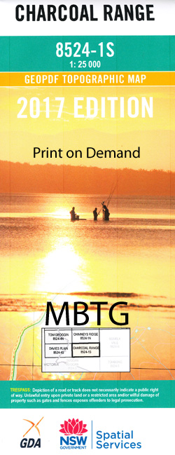

Charcoal Range 1-25,000 NSW Topographic Map 2017 Edition
Original price was: $16.95.$12.95Current price is: $12.95.
1 in stock
Description:
NEW 2022 EDITION AVAILABLE BELOW
Charcoal Range 1-25,000 Scale NSW Topographical Map 2017 old edition is usedfor Walking, 4WD, Fishing, Camping, Motorcycle, both On and Off Road, GoldProspecting and for those simply going for a family weekend drive.
Topographicalmaps show not only Contours of the Terrain but also Walking Tracks, Sealed andUnsealed Roads, Rivers, Creeks, Lakes, Historical Point of Interest, Old MineSites and National and State Park areas.
 Laminate and folded this NSW Topographical map, $12.00 see below
This map includes the following localities: Bark Camp Creek Beurina Bills Garden Creek Blackfellow Mountain Charcoal Gap Charcoal Gap Creek Charcoal Range Clapton Connors Camp Creek Connors Gap Feltons Creek Grose Halfpenny Hill Ingebirah Ingebirah Creek Ingebirah Gap Ingeegoodbee River Jacobs Jacobs Ladder Jacobs River Jimmys Stairs East Point Half Penny Jack Wall Creek Jack Walls Creek Jack Walls Range Jimmies Stairs Little Tin Mine Creek Lookout Lookout Creek Moyangul Moyangul or Pinch River Musslewood Flat Muzzlewood Flat Native Dog Flat North Blackfellow Penny Penny Hill Peters Creek mbtg Pigeon Springs Pigeon Springs Gap Pinch River Russian Gap Short Ridge Somen Mountain Somerset Hill Stockwhip Hill Suggan Buggan Range Swamp or Tingebirah Creek Thatchers Flat Creek Thatchers Hole Creek Thatchers Mountain Thatchers Mountain Creek The Beehive The Big Rocks Tongaroo or Jacobs River Wales Creek Walls Creek Wild Bull Creek Witts Camp Dray Bridge Creek Dray Ridge Creek Wallace Craigie Lookout The Brindle Bull Brindle Bull Ridge
| Scale: | 1:25000 |
| Latitude Range: | 36 37.5 S – 36 45.0 S |
| Longitude Range: | 148 15.0 E – 148 30.0 E |
| Approx Print Size: | 0.56m X 1.11m |
| Projection: | Transverse Mercator |
You may also like…
-
Charcoal Range 1-25,000 NSW Topographic Map
$16.95 – $29.95Select options This product has multiple variants. The options may be chosen on the product page