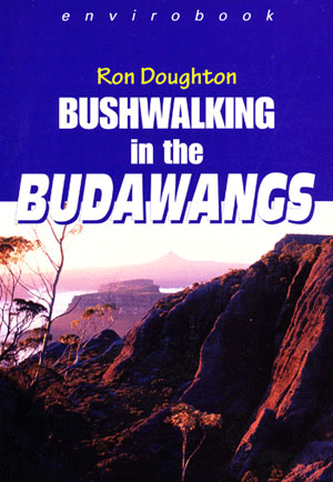
Bushwalking in the Budawangs
$34.95
8 in stock
Description:
Bushwalking in the Budawangs is the specialist guide to Morton and Budawang National Parks on the New South Wales South Coast.
The book is suitable for all park visitors from the ‘day tripper’ to experienced bushwalkers. There are full descriptions, with map reference points, of 43 bushwalks that suit all levels of ability.
Explore the caverns, archways, sculptured rock formations and spectacular cliffs and valleys of the National Parks.
148mm X 212mm 152 pages
3rd Edition 2004
Completely revised with maps and full colour photography.
ISBN 9780858810723
Budawangs Walks and Area 1-25,000 Scale Topographic Walking Maps
Long Gully Kalianna Ridge – The Castle return
Map Corang 1-25,000
Long Gully Kalianna Ridge – Monolith Valley – Mount Owen – Shrouded Gods – Mount Nibelung retur
Map Corang 1-25,000
Long Gully – Monolith Valley – Mount Cole – Camping Caves – Crooked Falls Return
Map Corang 1-25,000
Long Gully – Castle Gap – Byangee Mountain Return
Map Corang 1-25,000
Long Gully Road – Belowra Fire Trail and Creek – Yadboro Creek – Long Gully
Map Corang 1-25,000
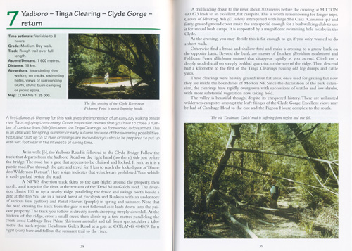
Yadboro – Pidgeon House Gorge – Caves – Longfella Ridge return
Maps Corang 1-25,000 and Milton 1-25,000
Yadboro – Tinga Clearing – Clyde Ridge return
Map Corang 1-25,000
Pidgeon House Mountain return
Map Milton 1-25,000
Little Forest Plateau – Porters Creek Dam – Ngaityung Falls – Gadara Point – Mount Bushwalker
Maps Milton 1-25,000 and Tianjara 1-25,000
Little Forest Plateau – Little Forest Trig – Rusden Head – Florance Head return
Map Milton 1-25,000
Little Forest Plateau – Rusden Head – Pidgeon House Creek – Oyster Overhang – Wombat Ridge Fire Trail return
Maps Corang 1-25,000 and Milton 1-25,000
Little Forest Plateau – Mount Bushwalker carpark – Mount Bushwalker return
Map Tianjara 1-25,000
Little Forest Plateau – Gaol House Pass – Claydons’s Creek – Clyde river return
Map Tianjara 1-25,000
Little Forest Plateau – Landing Ground Ravines and Rainforest
Map Tianjara 1-25,000
Little Forest Plateau – Lost World Caverns – Cliffside Walk – Landing Ground
Map Tianjara 1-25,000
Little Forest Plateau – The Pinnacles Walk
Map Tianjara 1-25,000
Little Forest Plateau – Gadara Point – Talterang Mountain return
Maps Milton 1-25,000 and Tianjara 1-25,000
Little Forest Plateau – Gadara Point – Talterang Mountain -Dummal Creek – Clyde River – Yadboro
Maps Milton 1-25,000, Tianjara 1-25,000 and Corang 1-25,000
Wog Wog – Corang Peak – Burrumbeet Brook – Corang River – Goodsells Creek return
Map Corang 1-25,000
Wog Wog – Corang Peak – Bibbenluke Mountain – Mount Owen – Monolith Vallet return
Map Corang 1-25,000
Wog Wog – Cockpit Swamp – Yadboro River – Long Gully
Map Corang 1-25,000
Mongarlowe – Currowan Creek – Currowan Falls return
Map Braidwood 1-25,000
Currockbilly Mountain Return
Maps Braidwood 1-25,000 and Brooman 1-25,000
Budawang Mountain return
Map Braidwood 1-25,000
The Corn Trail: Clyde Mountain – Buckenbowra River – No Name Fire Trail carpark
Maps Monga, Araluen and Nelligen 1-25,000
Clyde Mountain – Musgrave Creek return
Map Monga 1-25,000
Sassafras – Folly Point Return
Maps Sassafras, Tianjara and Endirck 1-25,000
Sassafras – Folly Point – Hollands Gorge – Angel Creek – Monolith Valley – Long Gully
Maps Endrick, Tianjara, Corang 1-25,000
Sassafras – Newhaven Gap – The Vines – Styles Creek – Mount Haughton – Mount Tarn – Monolith Gilly – Long Gully
Maps Endrick and Corang 1-25,000
Sassafras – Newhaven Gap – Foley Point – Munnuldi Falls – Sluice Box Falls – Sturgiss Mountain – The Vines return
Map Endrick 1-25,000
Sassafras – Newhaven Gap – Camp Rock – Island Mountain return
Map Endrick 1-25,000
Sassafras – Newhaven Gap – Quiltys Mountain – Hiddeen Valley return
Map Endrick 1-25,000
Boolijah Creek via Yarramunmun Fire Trail Return
Map Sassafras 1-25,000
Map Sassafras 1-25,000Black Range – Picture Canyon return
Map Nerriga 1-25,000
Yalwal – Skyline Plateau Traverse – Bundundah Creek – Morely Saddle – Danjera Creek – Yalwal
Map Yalwal 1-25,000
Nerriga– Round Mountain – Fosters Mountain – Square Top Mountain – Flat Top Mountain return
Map Endrick 1-25,000
Twelve Mile Road – Granite Falls – Wandandian Creek return
Map Tianjara 1-25,000
Ettrema – Quiera Clearing – Jingles Pass – Thomsons Walls, Jones Creek Caves – Sentry Box Canyon – Myall Creek return
Maps Touga and Nerriga 1-25,000
Bullfrog Creek – Ettrema Creek – Myall Creek return
Maps Touga and Nerriga 1-25,000
Tolwong – Billy Bulloos Canyon – Tryers Ridge – Tolwong Mines return
Map Caoura 1-25,000
Tolwong – Touga Trig – Wineglass Tor – Great Horseshoe Bend return
Maps Caoura and Touga 1-25,000
Ettrema – Churinga Head – Endrick River – Endrick Falls
Maps Nerriga and Touga 1-25,000
You may also like…
-
Corang 1-25,000 NSW Topographic Map
$16.95 – $28.95Select options This product has multiple variants. The options may be chosen on the product page -
Sassafras 1-25,000 NSW Topographic Map
$16.95 – $28.95Select options This product has multiple variants. The options may be chosen on the product page -
Yalwal 1-25,000 NSW Topographic Map
$16.95 – $31.95Select options This product has multiple variants. The options may be chosen on the product page -
Milton 1-25,000 NSW Topographic Map
$16.95 – $28.95Select options This product has multiple variants. The options may be chosen on the product page -
Monga 1-25,000 NSW Topographic Map
$16.95 – $28.95Select options This product has multiple variants. The options may be chosen on the product page -
Araluen 1-25,000 NSW Topographic Map
$16.95 – $28.95Select options This product has multiple variants. The options may be chosen on the product page -
Endrick 1-25,000 NSW Topographic Map
$16.95 – $28.95Select options This product has multiple variants. The options may be chosen on the product page -
Sale!
Braidwood 1-25,000 NSW Topographic Map
Original price was: $16.95.$12.95Current price is: $12.95.


