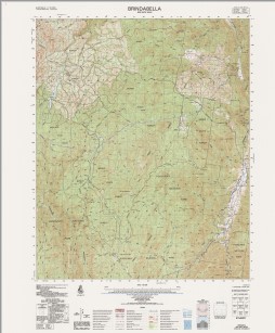
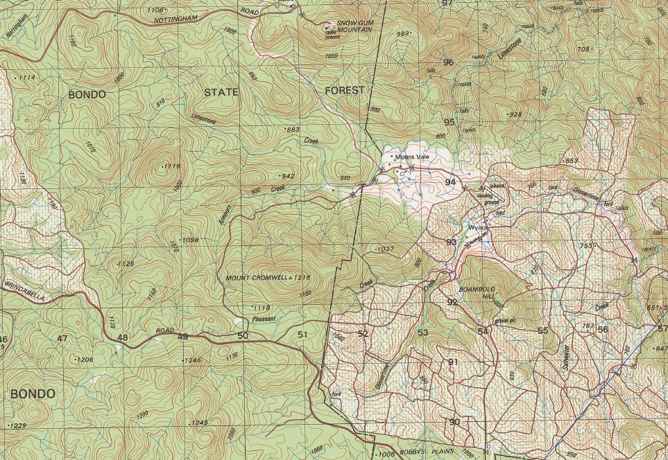
Brindabella 1-50000 Topographic Map 8627-3 NSW
$14.95
Description:
Brindabella 1-50000 Topographic Map 8627-3 NSW Print on Demand 1987 Edition
Locations within this Map
Armours Creek Andy Andy Range Bare Rock Big Dubbo Big Dubbo Hill Bobbys Plains Boambolo Hill Black Bottle Mountain Bramina Bramina Creek Mount Bramina Broken Cart Broken Cart Creek Browns Camp Creek Browns Camp Flat Browns Creek Browns Flat Chinamans Creek Coles Creek Concertina Flat Cooleman Creek Cromwell Mount Cromwell Crupper Gully Dead Horse Creek Emu Flat Creek Feints Creek Feints Range Fiery Range Franklin Gully Frog Porridge Gully Gang Gang Garnet Gass Creek Goobarragandra Goobarragandra River Greenhide Creek Half Moon Creek Half Moon Gap Hall Creek Happy Go Lucky Flat Happy Go Lucky Gully Horse Creek Jacks Creek Jacks Hill Jibeen Crupper Creek Frog Porridge Creek Goobarragandra River Right Band Branch Great Waterfall Branch of Horse Creek Mountain Lickhole Mount Lickhole Limestone Creek Log Hut Creek McDonald Creek Mcdonalds Flat Merrymans Flat Micalong Swamp Micks Creek Myers Creek Napier Never Never Creek Nimbo Nuggety Creek Oaks Creek Ottos Creek Ottos Gully Ottos Hill Perkins Flat Pheasant Creek Pinchgut Creek Pinchgut Gully Princes Creek Princes Flat Right Hand Branch of Goobarragandra River Roast Beef Creek Rocky Flat Saltwater Creek Sandy Flat Sandy Flat Creek Sassafras Creek Short Cut Creek Shortcut Gully Simons Creek Sulky Alex Hill Tommys Flat Wambat Creek Wambat Ground Wombat Creek Wombat Ground Yankee Ned Hill Diggers Creek Yates Camp Dinnertime Creek Bull Flat Bull Flat Creek Dubbo Creek Dubbo Falls Dubbo Flat Dubbo Hill Dinnertime Flat Dubbo Falls Cascades Black Bottle Micks Flat The Resting Paddock Broken Cart Clearing Brindabella County of Buccleuch Bramine Kentucky Peppercorn Creek
| Name: | Brindabella |
| Publisher: | Geoscience Australia (Australian Government) |
| Scale: | 1:50000 |
| Latitude Range: | 35° 15.0′ S – 35° 30.0′ S |
| Longitude Range: | 148° 30.0′ E – 148° 45.0′ E |
| Projection / Datum: | Universal Transverse Mercator, GDA94 or WGS84 |
| Approx Print Size: | 0.56m X 0.56m |
| Publication Date: | 1-Jun-87 |
You may also like…
-
Tidbinbilla 1-25,000 NSW Topographic Map
$16.95 – $31.95Select options This product has multiple variants. The options may be chosen on the product page -
Brindabella 1-25,000 NSW Topographic Map
$16.95 – $28.95Select options This product has multiple variants. The options may be chosen on the product page -
Taemas Bridge 1-25,000 NSW Topographic Map
$16.95 – $31.95Select options This product has multiple variants. The options may be chosen on the product page -
Bobbys Plain 1-25,000 NSW Topographic Map
$16.95 – $31.95Select options This product has multiple variants. The options may be chosen on the product page -
Couragago 1-25,000 NSW Topographic Map
$16.95 – $31.95Select options This product has multiple variants. The options may be chosen on the product page -
Umburra 1-25,000 NSW Topographic Map
$16.95 – $31.95Select options This product has multiple variants. The options may be chosen on the product page