Birdsville Track Design Interaction
$24.95
1 in stock
Description:
Birdsville Track Design Interaction
Driving the Birdsville Track is still one of the outbacks great adventures. The track began during the 1880s as the main stock route from Birdsville to Marree. It is a gateway to the Corner Country, accessed via the Simpson Desert and renowned for the Diamantina river, Birdsville Hotel and the ever popular Birdsville Races. The diversity of country between the four deserts, Tirari, Strzelecki, Sturt Stony and Simpson contrasted by the wetlands of Clayton river, Cooper creek and Mungerannie, the hills at Mungerannie Gap and the steaming hot bores, highlights the imagination of life during the early pioneering days.
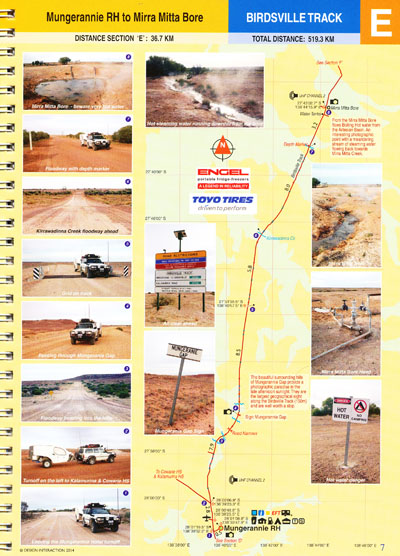
The Sectioned Maps will help you find everything of interest along the Track and point out potential road cautions in advance, supported by visual references, for the benefit of your safety.
The Track is sectioned into 8 parts (Section A-H). All Regional Roads and Public Access Routes. Full colour throughout. 28 pages including cover. 14 comprehensive map pages. All Tracks fully mapped with Garmin GPS 76CS. Datum WGS 84. Photographic references to associate with specific locations. Distances in kilometres. Elevations in metres. Colour coded track information indicating dips, crests, creek crossings, floodways, sharp bends, grids, gates, bogs, homestead tracks, historic sites. Photographic views. Geographic locations, towns and services. Size 180mm x 250mm spiral bound.
ISBN: 9780975800225


