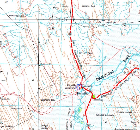
Birdsville 1-250,000 Topographic Map
$15.95 – $30.95
Description:
Print on Demand
Part of the Madigan Line, the Madigan Line isn’t named on the map
Part of the Birdsville Track
Old Roseberth ruins Birdsville Poeppel Corner Aboukir Adria Agosta Agra Alcona Alpena Annandale Ashby Atina Avella Avlona Barun Bira Bira Bowmans Lake Burmah Bygombo Bygombo Waterhole Cacoory Chatham Coodjah Coontamurra Creek Cudrivera Waterhole Daisy Dalmeny Diamantina River Dickerrie Dirrilong Durrang Eccles Eyre Eyre Creek Goodie Goodie Waterhole Grangefoyle Grayshall Gumborie Waterhole Gunegoomrie Waterhole Ichica Irene Kauri Waterhole Knowe Kuddaree Kuddaree Waterhole Kuntianna Waterhole Ladas Mount Lewis Listore Listore Creek Maracas Melita Mernie Mickrapyra Mirregin Moochala Waterhole Muddawarry Muncooney Muncoonie Muncoonie Lake East Muncoonie Lake West Muncoonie Waterhole Lake Nappanerica Neringee Nerrigan Newmains Niddrawodra Niddrawodra Waterhole Poeppels Corner Primrose Rosebery Schalton Semaine Shanks Corner Simpson Desert National Park Square Hill Squaretop Hill Taranga Waterhole Tarlina Terian Titheropatchie Lower Lake Titheropatchie Upper Lake Weemarrie Lake Weemarrie Weramo West Kuddaree Waterhole Wigugomrie Waterhole Yuluma The Diamantina Muellers Creek The Everard Old Roseberth Roseberth Birdsville Track Bowman Lake
| Name: | Birdsville |
| Publisher: | Geoscience Australia (Australian Government) |
| Scale: | 1:250000 |
| Latitude Range: | 25° 0.0′ S – 26° 0.0′ S |
| Longitude Range: | 138° 0.0′ E – 139° 30.0′ E |
| Projection / Datum: | Universal Transverse Mercator, GDA94 |
| Approx Print Size: | 0.44m X 0.67m |
| Publication Date: | 1-Jun-03 |


