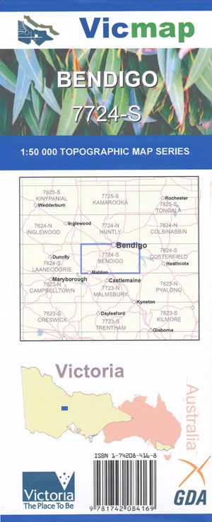
Bendigo 1-50,000 Vicmap
$12.00 – $24.00
Description:
Bendigo 1-50,000 Vicmap Topographic Map 7724S is used for Walking, 4WD, Fishing, Camping, Motorcycle, both On and Off Road, Gold Prospecting and for those simply going for a family weekend drive.
Topographical maps show not only Contours of the Terrain but Walking Tracks, Sealed and Unsealed Roads, Rivers, Creeks, Lakes, Historical Point of Interest, Old Mine Sites mgbt and National and State Park areas.
Main Features of this map includes:
Bendigo and Maldon Townships
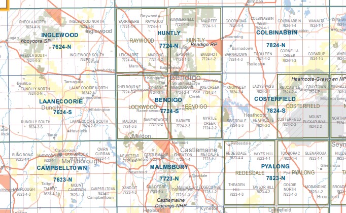
Bendigo CBD and below not north of the City, South East parts of the Greater Bendigo National Park, Spring Gully, Mandurang, Strathfieldsaye, Axe Creek, Wellsford, mbtg, Longlea State Forest and Commonwealth Land, Loyell State Forest, Strathdale, Lynch Hill, Axedale, Junortoun, Spring Gully, Mandurang, Spring Gully Reservoir, Diamond Hill, Koolamurt Park Scout Camp, mbtg, Channel Track, Emu Creek, part of Sandhurst Reservoir, part of Coliban Main Channel, Mandurang South, Leanganook Track, Sedgewick, part of Pilchers Bridge NCR, Eppalock, Mosquito Creek, part of Kimbolton SF, Comer Cove, mbtg, Harcourt North, Lyal, Sedgwick, edge of Harcourt, part of Great Bendigo NP Sandhurst Reference Area (no public access), Leanganook Track, Coliban Main Channel, Goom Gooruduron – Yearn Camping Area, mbtg, Great Southern Sheepshead Mine, part of Sedgwick SF, part of Pilchers Bridge NCR, part of Lyell SF, part of Kimbolton SF, part of Lake Eppalock, Balee Bay, Comer Cove, Kangaroo Arm, part of The Great Dividing Range, Eppalock EA, Mount Prospect, Mount Thorpe, mbtfg, Myrtle Creek, Hawkestone BR, Lyell Mine Track, Lyell Bridge, Mount Barker, Barkers Creek, James Hill, Sutton Grange, Mount Sargent, Mount Alexander RP, La Lara BA Gauwa Park, Shepards Flat Lookout, Langs Lookout.
West Bendigo, Kangaroo Flat, Lockwood, Shelbourone, Bald Hill, Bendigo RP, Sparrowhawk Gully BR, Specimen Hill, Green Gully Reservoir, Shelbourne NCR, Crusoe Reservoir, Lockwood-Marong Reservoir, mbtg, Lockwood South, part of The Great Dividing Range, Sandhurst Reservoir, Leanganook Track, Part of Great Bendigo NP, Big Hill High Level Reservoir, mbtg, Ravenswood, Bullock Creek, Walmer, Maldon, Bradford, Blue Hills, Pollard, Ravenswood South, part of The Great Dividing Range, Mount Gaspard, Porcupine Flat, mbtg, Nuggety, Maldon HR, Nuggety Hills, Peg Leg Gully, Fogarty Gap, Porcupine Hill, Pigeon Hill, Mount Tarrengower, Adair Track, Anzac Hill, Tatt Town Track, Muckleford Creek.
You may also like…
-
HUNTLY SOUTH 1-25,000 Vicmap Topographic Map 7724-1-S
$12.00 – $24.00Select options This product has multiple variants. The options may be chosen on the product page -
Malmsbury 1-50,000 Vicmap
$12.00 – $24.00Select options This product has multiple variants. The options may be chosen on the product page -
Huntly 1-50,000 Vicmap
$12.00 – $24.00Select options This product has multiple variants. The options may be chosen on the product page -
Pyalong 1-50,000 Vicmap
$12.00 – $24.00Select options This product has multiple variants. The options may be chosen on the product page -
Costerfield 1-50,000 Vicmap
$12.00 – $24.00Select options This product has multiple variants. The options may be chosen on the product page -
BENDIGO HEATHCOTE 1-100,000 Vicmap 7724-7824
$14.00 – $26.00Select options This product has multiple variants. The options may be chosen on the product page -
BENDIGO NORTH 1-25,000 Vicmap Topographic Map 7724-2-N
$14.00 – $26.00Select options This product has multiple variants. The options may be chosen on the product page -
LOCKWOOD NORTH 1-25,000 Vicmap Topographic Map 7724-3-N
$14.00 – $26.00Select options This product has multiple variants. The options may be chosen on the product page -
Campbelltown 1-50,000 Vicmap
$12.00 – $24.00Select options This product has multiple variants. The options may be chosen on the product page -
Bendigo 1-50,000 Vicmap
$12.00 – $24.00Select options This product has multiple variants. The options may be chosen on the product page -
Inglewood 1-50,000 Vicmap
$12.00 – $24.00Select options This product has multiple variants. The options may be chosen on the product page -
Laanecoorie 1-50,000 Vicmap
$12.00 – $24.00Select options This product has multiple variants. The options may be chosen on the product page -
BENDIGO SOUTH 1-25,000 Vicmap Topographic Map 7724-2-S
$14.00 – $26.00Select options This product has multiple variants. The options may be chosen on the product page


