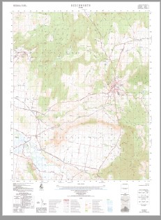
Beechworth 1-50000 Topographic Map 8225-3 VICTORIA 1985 Edition
$14.95
Description:
Print on Demand Geoscience Australia 1985 Edition 82253
Locations within this Map
Woolshed Park Wattle Grove Lyndale Lone Pine Bentleigh Park Golden Ball Donchi Pine Grove Roses Gwinganna Glenlock Amaroo Manmarra Dalkeith Beechworth Bald Rock Beechworth Fire Station Beechworth Magistrates Court Beechworth Park Beechworth Police Station Beechworth Post Office Beechworth Primary School Beechworth Prison Education Centre Beechworth Recreation Reserve Beechworth Secondary College Beechworth Telephone Exchange Bob Gully Bowman Bowmans Murmungee Fire Station Bowmans Murmungee Public Hall Bright Gully Buckland Gap Burgoigee Creek Byawatha Byrne Gully Cemetery Creek Chappell Gully Clear Creek Clear Creek Falls Cunningham Gully Curran Creek Deadman Creek Deep Creek Devils Elbow Dingle Range Dry Creek Mine Dyke Gully El Dorado Eldorado Fire Station Eldorado Post 0Ffice Eldorado Public Hall Everton Everton Fire Station Everton Hill Everton Primary School Everton Public Hall Everton Upper Primary School Everton-Bright Railway Fred Gully German Gully Graveyard Creek Green Wattle Creek Gummy Creek Hellshed Gully Two Mile Creek Holmes Creek Horseshoe Creek Hurdle Creek Kangaroo Falls Kangaroo Hill Kings Gully Kneebone Gully La Serena Creek Lake Kerferd Lake Sambell Limeburners Creek Long Gully Madman Gully Magpie Creek McLean Gully Monument Hill Mount Pilot Murmungee Murmungee Hall Native Dog Peak Neioff Gully Newton Falls O’Neil Gully Old Hands Creek Old Murmungee Hall One Mile Creek One Tree Hill Ovens Hospital Paddy Gully Pilot Range Pioneer Bridge Pound Creek Racecourse Creek Rawbottom Gully Red Hill Reid Creek Falls Ritchie Gully Rocky Gully Running Creek Sawpit Creek Seven Oaks Creek Sheep Station Creek Shepherds Creek Silver Creek Six Mile Creek Six Mile Range Smart Gully Snakes Head Creek Spring Creek Stockyard Gully Stony Creek The Flagstaff Upper Three Mile Creek Tin Creek Wangaratta-Everton-Beechworth Railway Wattle Gully Wombat Creek Wombat Hill Woolshed Falls Woorragee Woorragee Centenary Hall Woorragee Fire Station Woorragee Primary School Woorragee Public Hall Woorragee Telephone Exchange Eldorado Woolshed Reids Creek Tarrawingee Station Hurdle Flat Baarmutha Stanley Lower Everton Brookfield
| Name: | Beechworth |
| Publisher: | Geoscience Australia (Australian Government) |
| Scale: | 1:50000 |
| Latitude Range: | 36° 15.0′ S – 36° 30.0′ S |
| Longitude Range: | 146° 30.0′ E – 146° 45.0′ E |
| Projection / Datum: | Universal Transverse Mercator, GDA94 or WGS84 |
| Approx Print Size: | 0.56m X 0.56m |
| Publication Date: | 1-Jun-85 |
You may also like…
-
Beechworth Albury Wangaratta Adventure Map Rooftop
$11.95 – $25.00Select options This product has multiple variants. The options may be chosen on the product page -
Yackandandah 1-50,000 Vicmap
$12.00 – $24.00Select options This product has multiple variants. The options may be chosen on the product page


