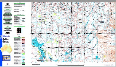
Balfour Downs 1-250,000 Topographic Map
$15.95 – $30.95
Description:
Print on Demand
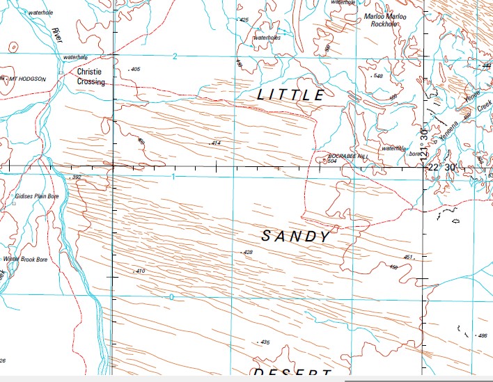
11 Mile Bore 17 Mile Bore 4 Mile Well 5 Mile Bore 5 Mile Creek 61 Well 7 Mile Well 9 Mile Bore Adrian Bore Ant Hill Peak Badgeannah Well Balfour Downs Battle Hill Battle Hill Well Bee Hill Bee Hill Mine Bett Bore Betty Bore Big Mulga Well Billabanna Well Billygoat Bore Bob Well Bonham Well Boorabee Hill Borehole Well Boundary Bore Brady Bore Bridgy Bore Bridgy Bridgina Well Brown Creek Brown Well Bubbawana Well Bugga Bugga Pool Bulgoo Well Bulldog Creek Bulldog Well Bullina Bore Bullstag Well Cairn Hill Camel Hill Canning Well Cape Warton Carrawarrum Pool Carrowina Creek Carrowina Pool Cattle Creek Cedar Creek Cement Bore Chielagunja Centre Bore Christie Crossing Christmas Creek Con Well Connelly Bore Coondamar Creek Coondoon Bore Coondoon Creek Coonina Well Coorapline Well Culby Well Daylight Creek Daylight Rockhole De Witts Bore Deep Well Dicks Bore Dingo Bore Dingo Well Dinney Well Donkan Bore Donkey Rockhole Dunkum Well Eastern Shed Bore Edenholme Bore Elimunna Bore Emu Bore Enacheddong Creek Enacheddong Waterhole Engine Well Esma Creek Ethel Creek Farrel Well Ferris Tank Figtree Waterhole Finney Well Flanagan Bore Florene Bore Foster Well Friday Well Garden Well Gnungathuddina Well Googhenama Creek Government Well Gregory Falls Gregory Pool Gum Well Gumtree Well Gunstock Well Hawkin Bore Haystack Well Howard Well Ironstone Bore Irwine Well Italy Bore Jardine Well Jinerabar Pool Junction Bore Junction Pool Junction Well Kallona Bore Kallona Creek Kallona Pool Kallona Rockhole Kent Well Kondy Creek Koomoonboonah Bore Koomoonboonah Creek Kujebookina Bore Kulkinbah Creek Kullawarri Well Kunningina Hill Kurrajong Creek Kurrana Creek Kurrana Well Larson Bore Larson Mill Well Laurie Bore Lewin Bore Lewin Creek Bore Lewis Bore Limestone Bore Linda Waterhole Lucy Bore Lynn Peak Macks Bore Marloo Marloo Rockhole Mary Bore Mcangor Bore Mcdonald Well Meecardagunna Bore Meecardagunna Pool Meechara Well Melon Well Merry Bore Mickerney Pool Mijindinah Well Milbeena Bore Millinedin Creek Moongemia Well Moseley Bore Mount Chin Bore Mount Cooke Mount Cooke Bore Mount Cooke Mine Mount Divide Mount Frank Mount Fraser Group Mount Hodgson Mount Lewin Mount Maggie Mount Mckay Mount Mclarty Mount Nicholas Group Mount Rudall Mount Trew Mulga Bore Nararoo Bore Nellie Creek Ngalkanginya Community No. 22 Well No. 46 Well No. 47 Well Nooganoonga Rockhole Noreena Creek Noreena Downs Old Camp Old Mia Well Peedonah Bore Peelbegunja Hill Picallina Well Pickering Creek Pindinyah Rockhole Pippina Well Poodawindi Bore Poonagarra Creek Pulbah Well Quartz Well Rat Hill Reece Well River Bank Well River Bore Russian Jack Creek Russian Jack Well Saddleback Hill Saddler Bore Salt Bush Bore Salt Well Carrowina Saltbush Range Satellite Bore Scotties Well Shag Pool Siddi Barrani Bore Spider Creek Springo Bore Stag Arrow Creek Stag Arrow Well Star Well Stock Route Bore Stock Route Creek Stockyard Bore Stockyard Pool Sugarloaf Hill Sunday Hill Syd Bore Talawana Talawana Creek Talawana Pool Three Jacks Well Tommyhawk Bore Tommyhawk Creek Tongololo Creek Tonys Bore Trig Bore Tubuddabudda Rockhole Tuccamunna Well Turkey Bore Turummunda Rockhole Twin Peaks Twin Rockholes Upper 5 Mile Mine Wadara Range Wadra Creek Wadra Rockhole Walbina Bore Walker Bore Wandanbah Well Wanderrie Well Waroongunyah Rockhole West Bore Whatsamatta Well White Bore White Well Whitewood Well Wickham Creek Wickham Well Windinah Bore Windy Corner Bore Windywindina Creek Woblegun Hill Wongarlong Rockhole Woora Woora Hills Woorumby Well Yandanunyah Rockhole Yandi Bore Yeneena Rockhole Yerawonyah Rockhole Yunera Pool Upper Five Mile Mine Googhenama Soak Nooganonga Pool Davis River Wongarlong Mount McLarty Kallona Waterhole Mount McKay Red Hill Bocrabee Hill Bograbee Hill Edenhome Bore Mickerny Pool Sugarloaf Meecandagunna Pool Badgeannah Jinarsoa Pool
| Name: | Balfour Downs |
| Publisher: | Geoscience Australia (Australian Government) |
| Scale: | 1:250000 |
| Latitude Range: | 22° 0.0′ S – 23° 00.0′ S |
| Longitude Range: | 120° 0.0′ E – 121° 30.0′ E |
| Projection / Datum: | Universal Transverse Mercator, GDA94 |
| Approx Print Size: | 0.44m X 0.67m |
| Publication Date: | 1-Jun-03 |


