Ashford 1-50000 NSW Topographic Map
$16.95 – $31.95
Description:
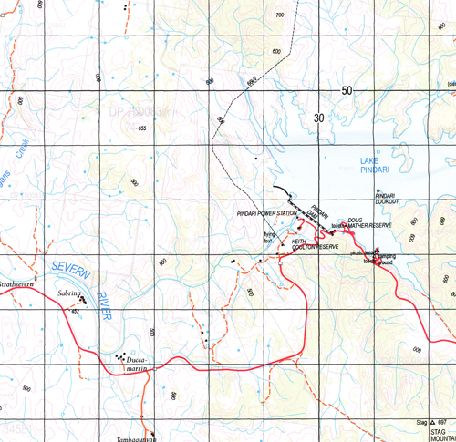
Ashford 9139-S 1-50,000 scale NSW Topographical map is used for Walking, 4WD, Fishing, Camping, Motorcycle, both On and Off Road, Gold Prospecting and for those simply going for a family weekend drive.
Topographical maps show not only Contours of the Terrain but also Walking Tracks, Sealed and Unsealed Roads, Rivers, Creeks, Lakes, Historical Point of Interest, Old Mine Sites and National and State Park areas.
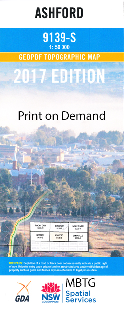
 We can Now LAMINATE and fold your map for $12.00. Just click on the image and add to the Trolley
NOW AVAILABLE PRINT ON DEMAND
Locations within this Map
Mount Ida Norwood Roseneath Myuna Albertina Stonehenge Barndee Amaroo Avondale South Valley The Brae Tarrangower Valhalla Braeside Arnsfelde Beaumont Nottingham Park Glenreagh Noonameena West Home St Albans Hillview Llanarth Belltarna Springvale Kia-Ora Locarno Glenroy Oaklyn Gorral Melrose Arimba Swamp Oak Oakhue Lilydale Madjeroi Arthurs Seat Cheviot Hills Sabrina Strathsevern Burrabogie Kincairney Harwood Trevanna Yambagunyah Ducca-Marrin Boorabie River View The Willows Glenbrook Karoola Coolandoon Almond Bank Clayton Chase Willows Strathbogie Raliegh The Ranch Leeholme Glen Gowrie Canoon East Home Windorah Worsley Severn Vale Severn Hills Ashford Arvid Apex Lookout Back Creek Apple Tree Waterhole Apple Tree Gully Athol Astley Ashford Cemetery Ashford Central School Ashford General Cemetery Ashford Landing Ground Ashford Post Office Ashford Sportsground Ashby Apple Tree Hole Apple Tree Battery Creek Beardy Cliff Big or Gurds Gully Bills Gully Boughyard Creek Branch Creek Browns Gully Bukkulla Bukkulla Tank Campogans Creek Chapman Cockatoo Hill Coffin Creek Companies Hill Crooked Creek Duncanmara Creek Egerton Eight Mile Falls Eight Mile Holes Creek Elephant Waterhole The First Falls The Fishing Ponds Frazer Gordons Falls Gulf Creek Gurds Creek Halls Lead Hawthorne Herding Yard Creek Hogarth Hurricane Creek Ironbark Creek Kangaroo Flat Creek Kathida Kellys Sugarloaf Cappogans Gully Cockatoo Gordonsfalls Gurds Gully Herding Yard Gully Hodges Creek Lands End Lands End Creek Lawsons Sheepstation Creek Lawsons Station Gully Lighthouse Hill Little Oaky Creek Lockerby Lorne Mcdonald Middle Creek The Mud Hole Muir Myall Creek New Hut Creek Nine Mile Creek Number Two Creek Oak Camp Creek Oak Camp Gully Oaky Creek Paddys Sugarloaf Pindari Creek Pindari Dam Pindari Lookout Pindaroi Creek Pipeclay Gully Playabout Playabout Creek Playabout Hill Quince Tree Creek Quince Tree Gully Raines Creek Raines Gully Red Hill Creek Red Hill Red Rock Red Rock Hole Red Rock Waterhole Reedy Camp Hole Reedy Creek Reedy Creek or Long Gully Rocky Creek St Andrews Sandy Creek Spring Creek Sawtooth Hills Scrubby Hill Scrub Hut Creek Severn River Nature Reserve Sheep Station Creek Snake Hole Creek Snakeholes Creek Snake Holes Gully Spring Gully Stag Stag Mountain Stockyard Creek Stevens Creek Stevens Gully Swamp Oak Creek Swamp Oak Waterhole Texas Road Well The Barbs The Cliffs The Gulf The Lighthouse The Mission The Scrubby Mountain The Sugar Loaf Thunderbolts Pocket Tighes Dam Tip Mountain Tower Hill Creek Trap Mountain Trelawney Village of Ashford Wells Crossing Westminster Mountain White Horse Gully Willow Grove Public School Diamond Gully Dingo Creek Dry Creek Lake Coulton Doug Mather Reserve Coulton Walk Yellow Dam Pindaroi Lawsons Sheep Station Keith Coulton Reserve Lake Pindari Mole River Round Hill Frazers Creek Pindari Reservoir Arrawatta Creek Bannockburn Creek
| Name: | Ashford |
| Publisher: | New South Wales Government |
| Scale: | 1:50000 |
| Latitude Range: | 29° 15.0′ S – 29° 30.0′ S |
| Longitude Range: | 151° 0.0′ E – 151° 30.0′ E |
| Datum: | GDA 94 |


