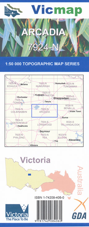
Arcadia 1-50,000 Vicmap
$12.00 – $24.00
Description:
Arcadia 1-50,000 scale Vicmap Topographical map 7924N is used for Walking, 4WD, Fishing, Camping, Motorcycle, both On and Off Road, Gold Prospecting and for those simply going for a family weekend drive.
Topographical maps show not only Contours of the Terrain but Walking Tracks, Sealed and Unsealed Roads, Rivers, Creeks, Lakes, Historical Point of Interest, Old Mine Sites mbtg and National and State Park areas.
Main Features of this map includes:
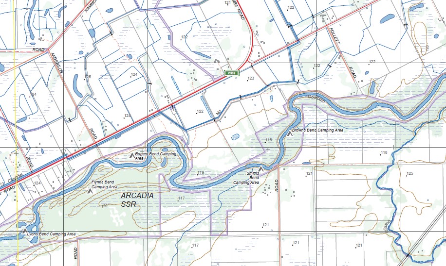
The Goulburn River from the Goulburn Weir to Arcadia in the North
The Towns of Arcadia, Rushworth, Murchison and Whroo, including the historical Gold Fossicking areas and the State Parks.
Arcadia, Goulburn River, MOORILIM, MIEPOLL, Murchison North, Arcadia SSR, Rogers Bend Camping Area, Flynns Bend Camping Area, Smiths Bend Camping Area, Lyons Bend Camping Area, Murchison East Caravan Park, Arcadia Punt Sand Bar Camping Area, Anderson Bend Camping Area, Martins Track Camping Area, Maritz Bend Camping Area, Paws Track Camping Area, Big Sand Bend Camping Area, mbtg, The Sandbar Camping Area & Boat Ramp, Arcadia South, Site Of Arcadia State School 1881-1919. mbtg, PRANJIP, Molka, WAHRING FIELD AIRFIELD, Dargalong, Wormangal Creek, CREIGHTONS CREEK BR, LITTLE BRANJEE CREEK BR, CASTLE CREEK BR
Rushworth, Murchison, WARANGA BASIN, RUSHWORTH – COLBINABBIN RAIL LINE (VICTRACK) BR, Redcastle –
Greytown State Forest, Belfast Hill KANGAROO Hill, RUSHWORTH BR, Dunlop Hill, CANADIAN Hill, Growlers Hill, Devon Hill, NUGGETY Hill, SPECIMEN Hill, Frenchmans Hill, Hard Hill, Chimamans Flat, Lake Waranga Caravan Park, Lake Waranga, Waranga Shores, Kuhnle Point, KIOTA, DOCTORS SWAMP WR, Cattanach Canal. Oval Bend Camping Area, Hutchinson Bend Camping Area, Murchison Camping Area, Murchison Caravan Park, Mckenzie Bend Camping Area, Mcmillan Sand Bar Camping Area, Hm Prison Dhurringile, Dhurringile, Lyons Bend Camping Area, ARCADIA SSR, Murchison East Caravan Park, Skys Caravan Park, Campbells Bend Camping Area, mbtg, Whroo, Wahring, Redcastle – Greytown State Forest, Bellamys Corner, MALAKOFF Hill, Balaclava Hill, Balaclava Battery Dam, WHROO NCR, GARDEN PICK HILL, BAILIESTON Historic Region, Humbug Mine Disused, Blacksmiths Dam, REEDY LAKE, NAGAMBIE WR, Angustown, Bailieston East, Goulburn Weir Backwater, Halliwells Island, Kirwans Bridge, Baxters Island, Turners Island, NAGAMBIE AIRFIELD, DARGALONG SSR, ECHUCA & WARANGA TRUST IRRIGATION PUMP & CHANNEL Historic Region, MURCHISON WATERWORKS TRUST Historic Region, WAHRING FIELD AIRFIELD
You may also like…
-
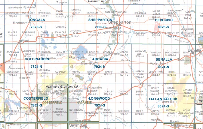
Murchison NORTH 1-25,000 Vicmap Topographic Map 7924-4-N
$14.00 – $26.00Select options This product has multiple variants. The options may be chosen on the product page -
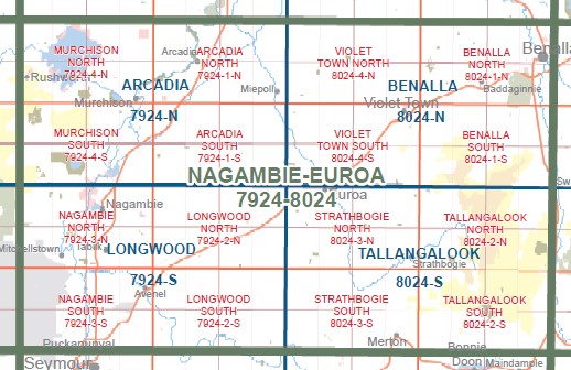
NAGAMBIE EUROA 1-100,000 Vicmap 7924-8024
$14.00 – $26.00Select options This product has multiple variants. The options may be chosen on the product page -
MURCHISON SOUTH 1-25,000 Vicmap Topographic Map 7924-4-S
$14.00 – $26.00Select options This product has multiple variants. The options may be chosen on the product page -
ARCADIA NORTH 1-25,000 Vicmap Topographic Map 7924-1-N
$14.00 – $26.00Select options This product has multiple variants. The options may be chosen on the product page -
Arcadia 1-50,000 Vicmap
$12.00 – $24.00Select options This product has multiple variants. The options may be chosen on the product page -
Bendigo 1-250,000 Topographic Map
$15.95 – $30.95Select options This product has multiple variants. The options may be chosen on the product page -
Longwood 1-50,000 Vicmap
$12.00 – $24.00Select options This product has multiple variants. The options may be chosen on the product page -
Shepparton 1-50,000 Vicmap
$12.00 – $24.00Select options This product has multiple variants. The options may be chosen on the product page -
ARCADIA SOUTH 1-25,000 Vicmap Topographic Map 7924-1-S
$14.00 – $26.00Select options This product has multiple variants. The options may be chosen on the product page -
Costerfield 1-50,000 Vicmap
$12.00 – $24.00Select options This product has multiple variants. The options may be chosen on the product page