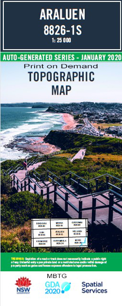
Araluen 1-25,000 NSW Topographic Map
$16.95 – $28.95
Description:
Araluen 1-25,000 NSW Topographic Map 8826-1-S Print on Demand
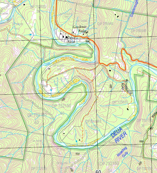
Araluen 88261s 1-25,000 scale NSW Topographical map is usedfor Walking, 4WD, Fishing, Camping, Motorcycle, both On and Off Road, Gold Prospecting and for those simply going for a family weekend drive.
Topographical maps show not only Contours of the Terrain but also Walking Tracks, Sealed andUnsealed Roads, Rivers, Creeks, Lakes, Historical Point of Interest, Old Mine Sites mbtg and National and State Park areas.
 Laminate and folded this NSW Topographical map $12.00 see below
This map includes the following localities: Back Creek Araluen Lower Araluen North Araluen Public School Araluen West Araluen Araluen Creek Bald Stony Creek Bald Stony Hill Benmanang Creek Benmanang Range Bettowynd Bettowynd Creek Big Oakey Creek Big Oaky Creek Buckenbowra River Buckenbowra State Forest Deua River Goodenough Gully Kennys Creek Little Oakey Creek Little Oaky Creek Long Flat Creek Merricumbene Creek Milo Moruya River Mudmelong Creek Musk Gully Neringla Creek Nosebag Gully Oak Creek Oakey Creek Oaky Creek Oban Creek Oban Gully Oban Hill Pidgeon Gully Pigeon Gully Quart Pot State Forest Rough Gully Sawmill Creek Sawpit Gully Shellharbour Creek Spring Gully Stockyard Creek Stockyard Gully Stony Creek Telowar Creek The Springs Weedy Flat Dirty Butter Creek Buckenbowra Merricumbene Neringla
| Scale: | 1:25000 |
| Latitude Range: | 35 37.5 S – 35 45.0 S |
| Longitude Range: | 149 45.0 E – 150 00.0 E |
| Approx Print Size: | 0.56m X 1.11m |
| Projection: | Transverse Mercator |
You may also like…
-
Araleun 1-100,000 Topographic Map Geoscience Australia
$15.95 – $27.95Select options This product has multiple variants. The options may be chosen on the product page -
Bendethera 1-25,000 NSW Topographic Map
$16.95 – $31.95Select options This product has multiple variants. The options may be chosen on the product page -
Bendoura 1-25,000 NSW Topographic Map
$16.95 – $31.95Select options This product has multiple variants. The options may be chosen on the product page -
Krawarree 1-25,000 NSW Topographic Map
$16.95 – $31.95Select options This product has multiple variants. The options may be chosen on the product page -
Monga 1-25,000 NSW Topographic Map
$16.95 – $28.95Select options This product has multiple variants. The options may be chosen on the product page


