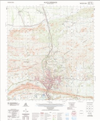
Alice Springs 1-50000 Topographic Map 5650-1 NT
$14.95 – $26.95
Description:
Alice Springs 1-50000 Topographic Map 5650-1 NT Print on Demand
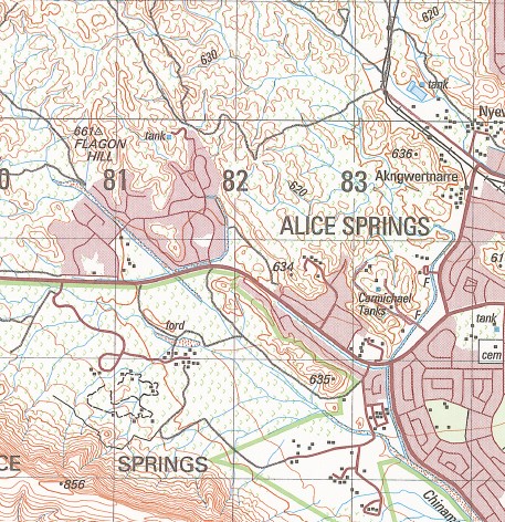
Alice Springs Namatjira Camp 10 Mile Bore 16 Mile Bore Acacia Hill School Adelaide House Museum Akngwertnarre Alice Springs Ambulance Station Alice Springs Community College Alice Springs Desert Park Alice Springs Fire Station Alice Springs General Cemetery Alice Springs Golf Course Alice Springs Health Centre Alice Springs High School Alice Springs Hospital Alice Springs Pistol Club Alice Springs Police Station Alice Springs Post Office Alice Springs Public Library Alice Springs Railway Station Alice Springs RSL Military Museum Alice Springs School of the Air Alice Springs Telegraph Station Alice Springs Telegraph Station Historical Reserve Anthelk-Ewlpaye Anzac Hill Anzac Hill High School Anzac Oval Aper-Alwerrknge Araluen Araluen Arts Centre Araluen Christian School Billy Goat Hill Blatherskite Park Bond Bond Springs Bond Springs Landing Ground Bradshaw Pre School Bradshaw Primary School Braitling Primary School Cairn O T Campbell Park Central Australian Aviation Museum Centralian Senior College Chalmers Park Charles Darwin University Alice Springs Charles River Chinaman Creek Choritja Hill Ciccone Colyer Creek Corkwood Bore D D Smith Park Davidson Park Davis Bore Desert Springs Driver East Side Eastern Bore Emily Emily And Jessie Gaps Nature Park Emily Gap Ewyenper-Atwatye Finlayson Park Flagon Flint Spring Flynn Flynn Park Forrest Park Frances Smith Memorial Park Frank Mcellister Community Park Fred McKay Museum Gillen Gillen Pre School Gillen Primary School Grey Park Hartley Street School Heavitree Gap Heavitree Gap Police Station Hoppy’s Camp Ida Stanley Pre School Ilparpa Ilparpa Swamp Ilparpa Swamp Wildlife Protected Area Ilperle-Tyathe Ilpiye-Ilpiye Ilyiperenye Inarlenge Irklancha Atwacha Irlpme Itwiyethwenge James Orr Overpass Jim Mcconville Park John Blakeman Bridge John Flynns Grave John Flynn’s Grave Historic Reserve Junction Waterhole Kempeana Park Kunoth Park Larapinta Larapinta Pre School Larapinta Primary School Larapinta Valley Lewis Gilbert Park Living Waters Lutheran School Lloyd Maynard Park McCoy Park Meyers Hill Mount Blatherskite Mount Everard Mount Forstor Mount Gillen Mount Johns Mount Nancy Mpwetyerre Museum of Central Australia National Pioneer Womens Hall of Fame Newland Park Nishan-E-Afghan Park Noonie Park North Side Emily Bore Nyewente Old Timers Traeger Museum Olive Pink Botanic Garden Our Lady Of Sacred Heart College Sadadeen Campus Our Lady Of Sacred Heart Primary School Perta Hill Plowman Park Poeppel Park Rhonda Diano Park Roberts Park Rona Glynn Pre School Ross Ross Park Primary School Rotaract Park Sadadeen Sadadeen High School Sadadeen Pre School Sadadeen Primary School Sadadeen Range Snow Kenna Park Spencer Hill Spencer Park St Phillips College Stuart Stuart Town Cemetery Stuart Town Gaol Taffy Pick Causeway Teppa Hill Teppa Hill Pre School The Gap The Residency Tom Brown Roundabout Town of Alice Springs Traeger Park Trevor Reid Park Tucker Park Undoolya Westland Park Wigley Gorge Yipirinya School Sixteen Mile Bore Alice Springs Waterhole John Flynns Grave Historic Reserve
| Name: | Alice Springs |
| Publisher: | Geoscience Australia (Australian Government) |
| Scale: | 1:50,000 |
| Latitude Range: | 23° 30.0′ S – 23° 45.0′ S |
| Longitude Range: | 133° 45.0′ E – 134° 0.0′ E |
| Projection / Datum: | Universal Transverse Mercator, GDA94 or WGS84 |
| Approx Print Size: | 0.56m X 0.56m |
| Publication Date: | 1-Jun-04 |
You may also like…
-
Alice Springs 1-1,000,000 Topographic Map Geoscience Australia
$16.95 – $28.95Select options This product has multiple variants. The options may be chosen on the product page -
Simpsons Gap 1-50000 Topographic Map 5650-4 NT
$15.95 – $27.95Select options This product has multiple variants. The options may be chosen on the product page -
Alice Springs 1-250,000 Topographic Map
$15.95 – $30.95Select options This product has multiple variants. The options may be chosen on the product page -
Alice Springs 1-100,000 Topographic Map
$15.95 – $27.95Select options This product has multiple variants. The options may be chosen on the product page


