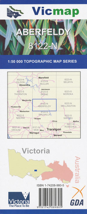
Aberfeldy 1-50,000 Vicmap
$12.00 – $24.00
Description:
Aberfeldy 1-50,000 scale Victorian Topographical map 8122N s used for Walking, 4WD, Fishing, Camping, Motorcycle, both On and Off Road, Gold Prospecting and for those simply going for a family weekend drive.
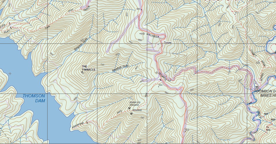
Topographical maps show not only Contours of the Terrain but Walking Tracks, Sealed and Unsealed Roads, Rivers, Creeks, Lakes, Historical Point of Interest, Old Mine Sites mbtg and both National and State Park areas.
Main Features of this map includes:
The very top of the map, The Bicentennial Trail Track from Rumpff Fals where the Track meets the McMillan Track
Northern part of the Thompson Dam
Aberfeldy, Matlock, Woods Point, Woods Point Gold Mine area, Mt Gregory, Yarra Ranges National Park, Frenchman’s Gap, Deep Saddle and Queen Bee Saddle, Mt Selma, Big River State Forest, Mount Shinlinglaw, Mount Singleton, Mount Useful, Toombon Gold Mines, Woods Point Gold Mines, Mount Sander, Mount Easton, Mount Gregory, Pleasant Mount, Red Jackel, The Triangle, Woods Point, Woods Point Gold Sites, Roberts, Mount Victor, part of McMillans Track mbtg, Champion Spur, Mount Stander, Mount Singleton, Fiddlers Green, MONGREL POINT, Sunflower Hill, Aberfeldy Nambruc SF, Upper Goulburn SF, MOUNT SHILLINGLAW, Mount Selma, Mount Useful, Deep Saddle, Queen Bee Saddle, Barkly River SF, mbtg, McMillans Spur, Connors Plain, Spring Hill Plateau, mbtg, Aberfeldy, Jericho, Mount Easton, Toombon, Easton Portal, Whitelaw Creek Bridge, Swingler, Red Jacket, Victor Spur, Mount Victor, MO U N T L O O K O U T S P U R, Northern Section of the Thompson Dam, Cast Iron Point mbtg, Sullivans, Jo r g e n s o n F l a t, Toombon Gold Mines Historic Region, O’Keefe, Comet Spur, Spud Spur, Mongrel Point, Mount Selma, O’t o o l e s F l a t, McGuire, Mount Useful Spur
Matlock, edge of Woods Point, McAdam Gap, Jessop Fire Bombing Base, Frenchmans Spur, Stockmans Spur, Big River, mbtg, Mount Gregory, Part of the Australian Alpine Walking Track, Shaw, Yarra Portal, Fehring Falls, mbtg, part of the Yarra Ranges National Park, Montys Hut, part of the Big River State Forest, The Oaks, The Triangle, Mount Gregory Reference Area, Turners Track, Cream Can Hill, Thompson Portal
You may also like…
-
JAMIESON SOUTH 1-25,000 Vicmap Topographic Map 8123-3-S
$14.00 – $26.00Select options This product has multiple variants. The options may be chosen on the product page -
McMahons Creek 1-50,000 Vicmap
$12.00 – $26.00Select options This product has multiple variants. The options may be chosen on the product page -
ABERFELDY SOUTH 1-25,000 Vicmap Topographic Map 8122-1-S
$14.00 – $26.00Select options This product has multiple variants. The options may be chosen on the product page -
Wellington 1-50,000 Vicmap
$12.00 – $24.00Select options This product has multiple variants. The options may be chosen on the product page -
Skene 1-50,000 Vicmap
$12.00 – $24.00Select options This product has multiple variants. The options may be chosen on the product page -
Walhalla Woods Point Adventure Map Rooftop
$12.95 – $25.00Select options This product has multiple variants. The options may be chosen on the product page -
MATLOCK SOUTH 1-25,000 Vicmap Topographic Map 8122-4-S
$14.00 – $26.00Select options This product has multiple variants. The options may be chosen on the product page -
JAMIESON NORTH 1-25,000 Vicmap Topographic Map 8123-3-N
$14.00 – $26.00Select options This product has multiple variants. The options may be chosen on the product page -
ABERFELDY NORTH 1-25,000 Vicmap Topographic Map 8122-1-N
$14.00 – $26.00Select options This product has multiple variants. The options may be chosen on the product page -
Walhalla South 1-25,000 Vicmap
$12.00 – $24.00Select options This product has multiple variants. The options may be chosen on the product page -
MATLOCK NORTH 1-25,000 Vicmap Topographic Map 8122-4-N
$14.00 – $28.00Select options This product has multiple variants. The options may be chosen on the product page -
Jamieson Licola Adventure Map Rooftop
$11.95 – $25.00Select options This product has multiple variants. The options may be chosen on the product page -
Neerim 1-50,000 Vicmap
$12.00 – $26.00Select options This product has multiple variants. The options may be chosen on the product page -
Thornton 1-50,000 Vicmap
$12.00 – $24.00Select options This product has multiple variants. The options may be chosen on the product page -
Walhalla North 1-25,000 Vicmap
$12.00 – $24.00Select options This product has multiple variants. The options may be chosen on the product page -
Australian Alpine Walking Track Map Set 2
$425.00 – $625.00Select options This product has multiple variants. The options may be chosen on the product page


