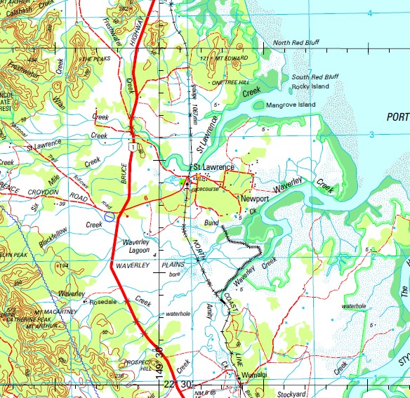
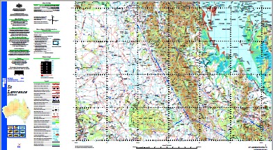
St Lawrence 1-250,000 Topographic Map
$15.95 – $30.95
Description:
Locations within this Map
Freshwater Overflow Lotus Park Cardowan Doreen Marylands Ivanhoe Morpeth Saltbush Park Mountain View Quail Island Rangeview Spring Valley Clairview Markwell Ripplebrook Beaconsfield Old Lotus Creek Killarney Mystery Park Harry James Lagoon Collaroy Waverley Batheaston Rosedale Bombandy Leichhardt Downs Carfax Croydon Prospect Hills Wilangi Granite Vale Hill End Barmount Falcon Downs Burwood Amedale Tanderra Old Yatton Charons Ferry Hillcrest Wangrabry May Downs Glenprairie Moanna Clarkwoods Montose Nullegai Langley Yatton Warwick Steinheim Longacre Stockyard Creek Mamelon Tooloombah Angleside Clive Knockane Essex Booroondara Wandilla Langdale Manly Foxleigh Merion Marlborough Old Barwon Junee Windemere Coreen Tartarus Clifton Apis Creek Middlemount St Lawrence Adeline Creek Aitken Creek Alligator Creek Amity Creek Apple Tree Creek Mount Arthur Back Creek Back Gully Creek Bald Hills Bar Mountain Bar Plains Barrack Creek Barren Island Battery Plain Bee Creek Bellarine Creek Big Coding Creek Birdies Gully Mount Bison Black Hole Black Soil Gully Black Swan Rock Blackburn Creek Blackfellow Creek Blacks Waterhole Blown Down Creek Bluchers Lagoon Blue Water Creek Bluewater Gap Mount Bluffkin Bora Creek Mount Bora Bore Creek Bottletree Creek Bowman Boyle Reef Bridge Creek Mount Bridget Broad Sound Broadsound Broadsound Range Brooks Shoal Brumby Creek Mount Brunswick Brussells Creek Buchanans Pool Mount Buffalo Bull Creek Bund Creek Bundarra Creek Bundoora Lake Bundoora Burkitt Roads Calabash Creek Camden Creek Cameron Creek Campbell Range Carlo Creek Catherine Peak Cattle Creek Cattle Gap Cedar Creek Charon Point Chinaman Creek Chinaman Ridges Christmas Creek Churchill Creek Clairview Bluff Clairview Creek Clairview Island Clarke Creek Clayton Clenents Creek Cliff Head Cliff Peak Clive Creek Clive Gully Coal Island Cobweb Mountain Cockatoo Flat Collaroy Creek Comet Ledge Comet Rock Connie Creek Connor Banks Connors Hump Connors River Connors River Ana Branch Coongie Plain Coppermine Creek Coxendean Crocodile Banks Crooked Creek Croydon Creek Curlew Sand Dacey Deep Creek Denison Creek Develin Creek Devlin Creek Dicks Creek Dingo Creek Dingo Hill Douglas Creek Dry Creek Duck Creek Eblana Mount Edward Eight Mile Creek Eighteen Mile Creek Elalie Emu Apple Creek Emu Creek Endrick Creek Eugene Eungy Hole Evelyn Peak Ewan Creek Five Mile Mountain Five Mile Waterhole Flat Island Passage Flock Pigeon Island Fort Arthur Fort Cope Fort St John Four Mile Creek Freshwater Creek Fuljames Gully Funnel Creek Gannet Rock Gap Creek Mount Gardiner German Creek Gibberland Gilnorchie Creek Gilnorchie Peak Gins Leap Glencoe Mount Gog Gordon Head Gorge Creek Gorge Gully Goude Creek Grace Creek Granite Creek Grass Hut Gully Graves Gully Graveyard Gully Grindstone Creek Gull Cay Hall Creek Harrys Creek Heifer Creek Herbert Creek Hill 60 Home Creek Honeycomb Creek Honeymoon Waterhole Horse Creek Hut Creek Infelix Islets Iron Pot Creek Iron Pot Mountain Ironpot Creek Isaac River Island Bluff Jardine Creek Mount Joss Jump Up Creek Junee Creek K Creek Kalarka Kangaroo Creek Kelman Kennedy Creek Kirkcaldy Knob Creek Knobbys Waterhole Kooltandra Kyour Creek Lambing Gully Lambing Waterholes Landsborough Creek Langdale Hill Mount Larry Leichhardt Creek Liebig Lily Creek Lily Waterhole Lily Waterhole Creek Lake Lindsay Little Bridge Creek Little Codling Creek Little Parrot Creek Long Bank Long Island Mount Lorne Lotus Lotus Creek Lucky Creek Mount Macartney Macksford Macksford Creek Macksford Waterhole Magdalen Creek Magog Creek Magog Range Mount Magog Mahalla Mahalla Creek Main Camp Lagoon Main Gully Main Range Creek Mamelon Creek Mount Mamelon Mangrove Island Marble Tree Creek Lake Mary May Downs Creek May Downs Waterhole Lake McDonald McEwan Creek McEwans Waterholes McEwen Island Mount McKenzie Meiklejohn Hill Mount Michael Middle Creek Middle Mountain Middle Passage Millers Mountain Montrose Creek Mount Moriah Mosquito Creek Mosquito Waterhole Mundi Creek Murchison Mount Mysie Narrows Rock Neebie New Country Creek Newport North Branch Creek North Point North Point Cays North Point Isles North Point Passage North Red Bluff Oaky Creek Obstruction Shoals Mount Og Ogmore One Fathom Patch One Tree Hill Palm Creek Parkinzonia Gully Parrot Creek Parsons Creek Peach Mountain Pearl Passage Perch Hole Perkins Creek Mount Phillip Pilot Reef Pine Mountain Pine Mountain Creek Pine View Pink Lagoon Pink Lily Lagoon Pint Pot Mountain Mount Pisgah Plain Creek Lake Plattaway Plum Creek Plumtree Creek Pomegranate Creek Pomegranite Creek Porphyry Hill Port Denison Lagoon Price Mountain Prospect Hill Race Passage Racecourse Creek Mount Raddle Raddle Creek Ramillies Rat Tail Sand Redcliffe Creek Mount Redcliffe Rickety Pocket Creek Rocky Island Rocky Peak Rolf Creek Roper Rosewood Island Ross Creek Round Waterhole Creek Roundish Island Rowdy Creek Ryton Saddlebag Creek Salt Hill Saltwater Creek Salvation Creek Sand Bank Bay Sand Fly Creek Sandy Creek Sandy Gully Sarsfield Sarsfield Creek Mount Sarsfield Schneider Creek Scott Creek Scour Creek Scrubby Creek Seaside Waterhole Seaview Hills Seven Mile Creek Seventeen Mile Creek Shannon Sheep Station Hill Sheepskin Creek Six Mile Creek Mount Slopeaway Snake Cays South Barren Island South Creek South Red Bluff Southport Hill Sprancis Gully Newport Conservation Park Spring Creek Spring Gully Mount St Catherine St George Waterhole St Lawrence Creek St Lawrence Creek North Branch St Lawrence Creek South Branch Stephens Creek Mount Stewart Stony Creek Stoodleigh Stoodleigh Creek Stotts Creek Strathmuir Styx Styx River Sugarbag Creek Sugarloaf Surveyors Creek Swampy Creek Tableland Creek Tail Rock Ten Mile Creek Ten Mile Waterhole The Alps The Brothers The Cousins The Hoogly The Knob The Lake The Muddy Waterholes The Rockys The Sisters The Tower Thirsty Sound Thirteen Mile Gully Three Mile Creek Tickle Toby Creek Tide Island Tin Case Creek Tin Case Gap Tin Hut Creek Tom Kelly Creek Mount Toobier Tooloombah Creek Connors River Top Anabranch Top Island Tornado Rocks Turkey Creek Turners Hut Creek Turtle Island Two Mile Creek Two Mile Gully Ungle Waterhole Upper Head Mount Upright Mount Vince Vinegar Hill Wambah Creek Wangrabry Creek Washpool Lagoon Waverley Creek Waverley Knob Waverley Lagoon Waverley Plains Wellington Creek Mount Wellington West Side Island Whelan Creek White Bluff Mountain White Cliff Wieta Wild Duck Island Windeyers Hill Wire Yard Creek Woods Island Woodstock Creek Wran Creek Wright Bank Wumalgi Wyndham Yard Gully Yatton Creek Yellow Creek Yellow Waterhole Clayton Conservation Park Tooloombah Creek Conservation Park Valkyrie Mackenzie River Charon Point Conservation Park Murray Creek West Channel Henry James Lagoon North Point Pass Double Rocks Meiklejohn Mountain Sugarloaf Mountain Flock Pigeon Islet Tide Islands McEwan Island Mount Ewen Islet West Side Islet Connors Banks Saltbush Park Number Five Mangrove Islands Port of Saint Lawrence Saint Lawrence Creek Sudbury Rookwood Funnell Creek Sea View Hill Saint Lawrence Saint Lawrence Township Waverley Nob The Hooghly The Hugli Turtle Islet Waverley Station Waverly Creek Campbell Creek Saint Catherine Peak Mount Saint Catherine Foyle Park Wood Island Lucky Creek Waterhole Mount Philip Cosmos Wangrabby Creek Black Gully Creek Back Gully Spake Brussels Creek Rocky Mountains Isaacs River Tooloombah Gap Cockatoo Waterholes German Creek Mine
| Name: | St Lawrence |
| Publisher: | Geoscience Australia (Australian Government) |
| Scale: | 1:250000 |
| Latitude Range: | 22° 0.0′ S – 23° 00.0′ S |
| Longitude Range: | 148° 30.0′ E – 150° 0.0′ E |
| Projection / Datum: | Universal Transverse Mercator, GDA94 |
| Approx Print Size: | 0.44m X 0.67m |
| Publication Date: | 1-Jun-05 |


